
Marshland, Oregon
Marshland, Oregon | |
|---|---|
 An aerial view of Marshland | |
 Marshland  Marshland | |
| Coordinates: 46°06′40″N 123°17′10″W / 46.111°N 123.286°W | |
| Country | United States |
| State | Oregon |
| County | Columbia |
| Elevation | 53 ft (16 m) |
| Time zone | UTC-8 (Pacific (PST)) |
| • Summer (DST) | UTC-7 (PDT) |
Marshland, formerly known as Skunk Cabbage Flat, is an unincorporated community in Columbia County, Oregon, United States.[1][2] It was settled by Z.B. Bryant in 1862. Its post office was established around 1873. It closed in 1960.[2]
References[edit]
- ^ "Marshland". Geographic Names Information System. United States Geological Survey, United States Department of the Interior. Retrieved December 15, 2010.
- ^ a b McArthur, Lewis A.; McArthur, Lewis L (2003) [1928]. Oregon geographic names. Portland, Oregon: Oregon Historical Society Press. p. 613. ISBN 0-87595-277-1.
Municipalities and communities of Columbia County, Oregon, United States | ||
|---|---|---|
| Cities | 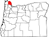 | |
| CDPs | ||
| Other unincorporated communities | ||
This Columbia County, Oregon state location article is a stub. You can help Wikipedia by expanding it. |