
Marble, North Carolina
Marble, North Carolina | |
|---|---|
.jpg) | |
 Marble Location within the state of North Carolina | |
| Coordinates: 35°10′37″N 83°58′35″W / 35.17694°N 83.97639°W | |
| Country | United States |
| State | North Carolina |
| County | Cherokee County, North Carolina |
| Area | |
| • Total | 1.10 sq mi (2.84 km2) |
| • Land | 1.10 sq mi (2.84 km2) |
| • Water | 0.00 sq mi (0.00 km2) |
| Elevation | 1,680 ft (510 m) |
| Population (2020) | |
| • Total | 278 |
| • Density | 253.65/sq mi (97.89/km2) |
| Time zone | UTC-5 (Eastern (EST)) |
| • Summer (DST) | UTC-4 (EDT) |
| ZIP codes | 28905 |
| Area code | 828 |
| FIPS code | 37-41220 |
| GNIS feature ID | 2628642[2] |
Marble is an unincorporated community and census-designated place (CDP) in Cherokee County, North Carolina, United States. As of the 2010 census it had a population of 321.[3]
History[edit]
Marble got its name from various marble quarries in the community. Currently, none are functioning, and all have filled with water. The Cherokee County Courthouse, one of few county courthouses in the U.S. constructed entirely of marble, was made with marble from the community.[4]
Marble’s post office opened in 1881.[5] Marble Elementary School was built in 1961.[6] Nonprofit manufacturer Industrial Opportunities Inc. was established at the Marble Activity Center in 1974.[7] A four-lane highway between Murphy and Andrews was built through Marble around 1977.[8]
Law enforcement[edit]
Marble is served by the town of Andrews Police Department.[9][failed verification] According to the 2012 Crime Rate Index,[10] Marble was rated a rape crime risk of 131 and a murder crime risk of 111. Marble also scored 81 for vehicle theft and 58 for larceny. All scores are compared to a national average of 100. North Carolina average is 103.[10] With a population of only 321, one event can exaggerate numbers dramatically.[citation needed]
Demographics[edit]
| Census | Pop. | Note | %± |
|---|---|---|---|
| 2020 | 278 | — | |
| U.S. Decennial Census[11] | |||
As of the 2010 Census, there were 321 people,[3] of which 162 were male and 159 were female. The 2010 population density was 293 people per square mile.[12]
Economy[edit]
Occupations[edit]
19.1% of individuals over the age of 16, are employed in management or professional industries. 19.1% are employed in the service industry, 16.9% are employed in sales or office industries, 14.9% are employed in construction, extraction and maintenance while the remaining 28.3% are employed in production and transportation.
As of 2000, 12.3% of people were below the poverty line.[13]
Household income[edit]
7.5% make less than $10,000 per year. 11.4% make between $10,000 and $14,999. 27.3% make between $15,000 and $24,999 per year. 14.2% make between $50,000 and $74,999 per year and 24.5% make between $35,000 and $49,999 per year. 14.2% make between $50,000 and $74,999 per year while the remaining 3.6% make over $75,000 per year.
As of 2000, 1.7% of Marble individuals were unemployed, while median household income was $28,553.[13]
Education[edit]
Schools and colleges[edit]
Marble is in close proximity to Tri-County Community College which has campuses in Peachtree, Robbinsville, and Marble.[14]
Public education[edit]
The public school system (Cherokee County Schools) is run by the Cherokee County Board of Education.[15]
Children in Marble attended Marble Elementary School at 2230 Airport Road until 2017. This school covered grades pre-K to 5th grade and was given a GreatSchools rating of 3/10.[16]
Since 2017 students from Marble attend Andrews Elementary, Middle and High School in the town of Andrews. As of 2016, the schools both scored 4/10 on GreatSchools.[17][18]
Transportation[edit]
Highways[edit]
Marble sits on US 19/129/74, which runs northeast-southwest between Andrews and Murphy. Airport Road (SR 1428) runs through Marble and was US 19 until 1979. The road ends near Murphy, and in Andrews at the west entrance. Slow Creek Road (141) runs south toward Erlanger Western Carolina Hospital in Peachtree.
Airport[edit]
Western Carolina Regional Airport (ICAO: KRHP, FAA LID: RHP), known locally as the Murphy Airport, Andrews Airport, or Andrews-Murphy Airport, is located approximately 4.5 miles (7.2 km) east of Marble.
Geography[edit]
Topography[edit]
Marble is located in the southeastern United States in the far western portion of North Carolina, approximately halfway between Atlanta, Georgia and Knoxville, Tennessee.[19] The location in the Blue Ridge Mountains has helped the community retain a rural character, surrounded by wildlife such as bear, deer, and recently reintroduced elk.[20]
According to the United States Census Bureau, the Marble CDP has a total area of 1.1 square miles (2.8 km2), all land.[3]
Climate[edit]
Marble has a humid subtropical climate, (Cfa) according to the Köppen classification, with hot, humid summers and mild, but occasionally cold winters by the standards of the southern United States.[21]
July highs average 85 °F (29 °C) or above, and lows average 55 °F (12.8 °C). Infrequently, temperatures can even exceed 100 °F (38 °C). January is the coldest month, with an average high of 48 °F (9 °C), and low of 33 °F (.6 °C).
Like the rest of the southeastern U.S., Marble receives abundant rainfall, which is relatively evenly distributed throughout the year. Average annual rainfall is 55.9 inches (1,420 mm). Blizzards are rare but possible; one nicknamed the 1993 Storm of the Century hit the entire Eastern United States in March 1993.
| Month | Jan | Feb | Mar | Apr | May | Jun | Jul | Aug | Sep | Oct | Nov | Dec |
|---|---|---|---|---|---|---|---|---|---|---|---|---|
| Average High Fº(Cº) | 47.8 (8.8)
|
52.2 (11.2)
|
61.1 (16.2)
|
69.9 (21.0)
|
77.3 (25.2)
|
83.3 (28.5)
|
85.8 (29.9)
|
85.6 (29.8)
|
80.7 (27.0)
|
71.8 (22.1)
|
61.9 (16.5)
|
51.4 (10.8)
|
| Average Low Fº(Cº) | 24.1 (-4.4)
|
26.1 (-3.3)
|
32.9 (0.5)
|
39.9 (4.4)
|
49.1 (9.5)
|
56.8 (13.8)
|
61.4 (16.3)
|
60.9 (16)
|
54.8 (12.7)
|
41.6 (5.3)
|
34.2 (1.2)
|
26.8 (-2.9)
|
| Precipitation Inches(mm) | 5.2 (132)
|
5.2 (132)
|
6.0 (152.4)
|
4.6 (116.8)
|
4.6 (116.8)
|
4.2 (106.7)
|
5.5 (139.7)
|
4.1 (121.9)
|
3.7 (94.0)
|
3.3 (83.2)
|
4.1 (104.1)
|
4.8 (121.9)
|
Culture[edit]
Situated in the midst of the Appalachian Mountains, Marble has a rich heritage and a rural character.
Local festivals and celebrations[edit]
The bi-annual Celebration of Flight air show, located at the Andrews-Murphy Airport 4 miles (6 km) northeast of Marble, is a huge presentation of aircraft, both vintage and hi-tech.[citation needed]
Religion[edit]
Historically, religion has been a very important part of Appalachian life. Christianity is predominant in Marble and the surrounding communities. Baptist Christian faiths are well represented here. Some local churches are Marble Springs Baptist Church, Emanuel Baptist Church, Fair-view Church and Kingdom Hall-Jehovah's Witness.[citation needed]
Media[edit]
Marble and the surrounding area are served by a few local television stations, numerous local radio stations that broadcast several genres of music, sports, news and talk radio, plus three local newspapers.
A local television station is W31AN (Channel 31) based in Murphy.
Marble is served by eight local radio stations. WCVP-AM (600), WCNG-FM (102.7), and WKRK-AM (1320) are based in Murphy. WCVP-FM (95.9) is in Robbinsville, and WFSC-AM (1050), WPFJ-AM (1480), WFQS-FM (91.3), and WNCC (96.7) are based in Franklin.
The only newspaper in Cherokee County is the Cherokee Scout, which is based in Murphy.
Notable people[edit]
- Roger West, local politician
Nearby communities[edit]
References[edit]
- ^ "ArcGIS REST Services Directory". United States Census Bureau. Retrieved September 20, 2022.
- ^ a b U.S. Geological Survey Geographic Names Information System: Marble, North Carolina
- ^ a b c "Geographic Identifiers: 2010 Demographic Profile Data (G001): Marble CDP, North Carolina". U.S. Census Bureau, American Factfinder. Archived from the original on February 12, 2020. Retrieved December 30, 2014.
- ^ Voyles, Bruce (January 17, 2024). "Five courthouses in Cherokee County". Cherokee Scout. Murphy, NC: Community Newspapers Inc. p. 5A. Retrieved January 21, 2024.
- ^ Lewis, J.D. "Cherokee County, NC Post Offices - 1839 to 1971". Carolana.com.
- ^ McKeever, Mrs. Hobart (January 29, 1961). "Cherokee County Shows Greatest Progress During 1950-60 Decade". Asheville Citizen-Times. p. 77. Retrieved March 21, 2024.
- ^ "Building our Foundation..." Quest. Andrews, N.C. Winter 2014. p. 3. Retrieved March 31, 2024.
- ^ Ward, Trawick (April 1977). An Archaeological Survey of the New U.S. 19-129 Route Between Andrews and Murphy in Cherokee Co (PDF). The Research Laboratories of Anthropology, University of North Carolina Chapel Hill.
- ^ "Andrew's Police Department". Retrieved August 10, 2016.
- ^ a b "2012 Crime Rate Index for Marble, NC". CLRSearch.com. Retrieved August 10, 2016.
- ^ "Census of Population and Housing". Census.gov. Retrieved June 4, 2016.
- ^ "Census 2010 data". zipcodedownload.com. Retrieved February 5, 2013.
- ^ a b "Demographic Information". ZIPSkinny.com. Archived from the original on January 17, 2010. Retrieved August 10, 2016.
- ^ "Tri-County Community College Website" Archived 2011-07-03 at the Wayback Machine. Retrieved August 10, 2016.
- ^ "Cherokee County Schools". Retrieved August 10, 2016.
- ^ "Marble Elementary". GreatSchools.org. Retrieved August 10, 2016.
- ^ "Andrews Middle". GreatSchools.org. Retrieved August 10, 2016.
- ^ "Andrews High". GreatSchools.org. Retrieved August 10, 2016.
- ^ "Distance from Knoxville, TN to Atlanta, GA". MapQuest. Retrieved August 10, 2016.
- ^ "Western North Carolina and Southern Appalachians Ecology". HikeWNC.info. Retrieved August 10, 2016.
- ^ "Koppen Classification Map". About.com. Retrieved August 10, 2016.
- ^ "Marble, NC Weather Data". WeatherBase.com. Retrieved August 10, 2016.
Municipalities and communities of Cherokee County, North Carolina, United States | ||
|---|---|---|
| Towns | 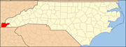 | |
| CDP | ||
| Other communities | ||
| Indian reservation | ||
| Footnotes | ‡This populated place also has portions in an adjacent county or counties | |