
Lal Mandi Footbridge
Lal Mandi Footbridge | |
|---|---|
 | |
| Coordinates | 34°4′5.81″N 74°48′44.55″E / 34.0682806°N 74.8123750°E |
| Carries | Bicycles, Pedestrians |
| Crosses | Jhelum |
| Locale | Srinagar, Jammu and Kashmir, India |
| Preceded by | Abdullah Bridge |
| Followed by | Amira Kadal |
| Characteristics | |
| Design | Suspension Bridge |
| Material | Concrete, Steel |
| Total length | 130 metres (430 ft) |
| Width | 4 metres (13 ft) |
| Longest span | 66 metres (217 ft) |
| No. of spans | 3 |
| Piers in water | 2 |
| History | |
| Opened | 13 July 2005 |
| Location | |
 | |
The Lal Mandi Footbridge is a suspension-type pedestrian bridge located in the city of Srinagar in the Indian union territory of Jammu and Kashmir. It connects Wazir Bagh areas of the city to the city centre Lal Chowk.
History[edit]
It is the first suspension-type bridge to come across the Jhelum in the city.[1] It was constructed over a period of two years under the PDP-Congress coalition government in the State led by Mufti Muhammad Sayeed and has helped greatly in easing the traffic congestion in the city centre.[2]
Location[edit]
The bridge is vital walkway located in Srinagar, in the neighborhood of Tyndale Biscoe School.
Usage[edit]
The bridge busiest walkway which connects residential area of Wazir Bagh to Lal Chowk. It is mostly used by Tyndale Biscoe School students.
See also[edit]
- Zero Bridge
- Abdullah Bridge
- Amira Kadal
- JK Krishi Vikas Cooperative Ltd.
References[edit]
- ^ "Bridges of Srinagar". Archived from the original on 17 February 2015.
- ^ "People Prefer Lal Mandi Footbridge".
Gallery[edit]
-
 A view of Footbridge.
 -
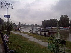 Footbridge and Jhelum.
 -
 Footbridge connecting Abi Guzar Bund and Silk Factory road.
 -
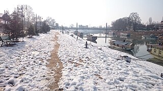 A view of Footbridge during winter.


This article about a bridge in India is a stub. You can help Wikipedia by expanding it. |