
File:AtlanticCoastPipeline map.pdf

Size of this JPG preview of this PDF file: 800 × 543 pixels. Other resolutions: 320 × 217 pixels | 640 × 434 pixels | 1,024 × 695 pixels | 1,280 × 868 pixels | 1,922 × 1,304 pixels.
Original file (1,922 × 1,304 pixels, file size: 351 KB, MIME type: application/pdf)
| This is a file from the Wikimedia Commons. Information from its description page there is shown below. Commons is a freely licensed media file repository. You can help. |
Summary
| Description |
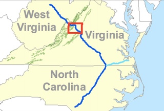
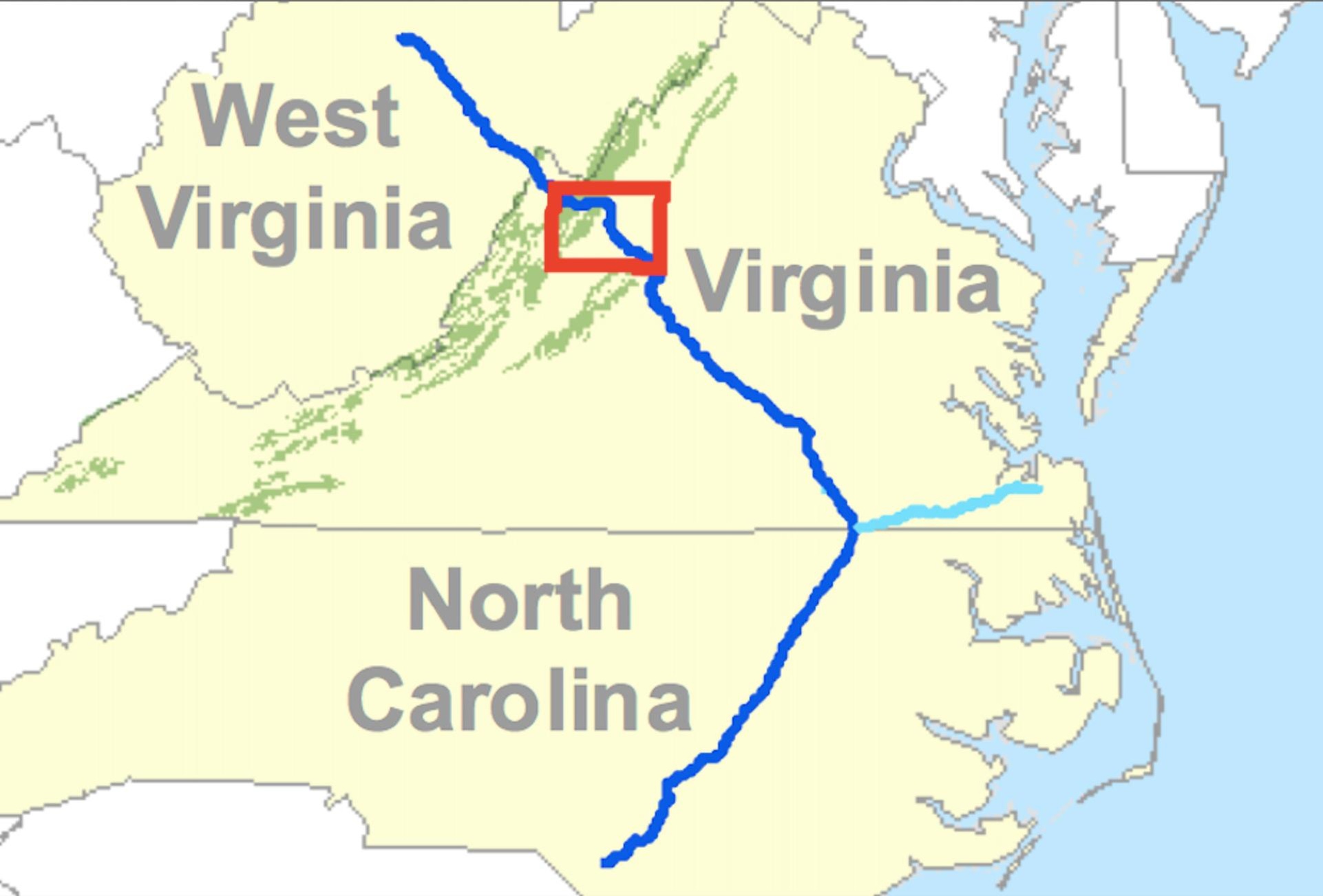
English: Map of the proposed Atlantic Coast Pipeline Project as it runs through West Virginia and North Carolina |
| Date | |
| Source | https://www.fs.usda.gov/Internet/FSE_DOCUMENTS/stelprd3824625.pdf |
| Author | US Forestry Services |
Licensing
This image is a work of the Forest Service of the United States Department of Agriculture. As a work of the U.S. federal government, the image is in the public domain.
|
File history
Click on a date/time to view the file as it appeared at that time.
| Date/Time | Thumbnail | Dimensions | User | Comment | |
|---|---|---|---|---|---|
| current | 14:27, 16 April 2017 |  | 1,922 × 1,304 (351 KB) | Comfr | resize |
| 04:16, 16 April 2017 | No thumbnail | 0 × 0 (1.09 MB) | Comfr | User created page with UploadWizard |
File usage
The following pages on the English Wikipedia use this file (pages on other projects are not listed):