
Buggenum
Buggenum
Bögkeme | |
|---|---|
Village | |
 View on the St Aldegundis Church and the village | |
 Coat of arms | |
 Buggenum Location in the Netherlands  Buggenum Location in the province of Limburg in the Netherlands | |
| Coordinates: 51°14′N 5°59′E / 51.233°N 5.983°E | |
| Country | Netherlands |
| Province | Limburg |
| Municipality | Leudal |
| Area | |
| • Total | 4.17 km2 (1.61 sq mi) |
| Elevation | 22 m (72 ft) |
| Population (2021)[1] | |
| • Total | 940 |
| • Density | 230/km2 (580/sq mi) |
| Time zone | UTC+1 (CET) |
| • Summer (DST) | UTC+2 (CEST) |
| Postal code | 6082[1] |
| Dialing code | 0475 |
| Major roads | N273 |
Buggenum (Dutch pronunciation: [ˈbʏxənʏm]; Limburgish: Bögkeme [ˈbœɡəmə]) is a village in the Dutch province of Limburg. It was a part of the municipality of Haelen until 2007, when it merged into the municipality of Leudal. It lies about 5 km north of Roermond.
History[edit]
The village was first mentioned in 1230 as Bugnem, and means "settlement of Buggo (person)".[3] Buggenum developed in the Early Middle Ages along the Maas. It used to be part of the County of Horne and later became part of the Prince-Bishopric of Liège. It became an independent heerlijkheid in 1679. Up to 1949, there was a ferry to Roermond near the village.[4]
The Catholic St Allegundis Church is a three aisled church. The choir still dates from around 1400. The remainder was destroyed in 1944. The current church is Gothic Revival style was built between 1948 and 1949, and a tower was added in 1958.[4]
Malborgh estate is a castle-like building with two corner towers. In 1470, it became owned by the St Elisabeth monastery. In 1798, it became private property and received its current shape in 1830.[4]
Buggenum was home to 668 people in 1840.[5] Buggenum was a separate municipality until 1942, when it was merged with Haelen.[6]
Gallery[edit]
-
 Estate Malborgh
 -
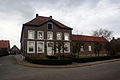 Farm in Buggenum
 -
 Farm Leynhof
 -
 Destroyed railway bridge during World War II


References[edit]
- ^ a b c "Kerncijfers wijken en buurten 2021". Central Bureau of Statistics. Retrieved 25 April 2022.
- ^ "Postcodetool for 6082AA". Actueel Hoogtebestand Nederland (in Dutch). Het Waterschapshuis. Retrieved 25 April 2022.
- ^ "Buggenum - (geografische naam)". Etymologiebank (in Dutch). Retrieved 25 April 2022.
- ^ a b c Sabine Broekhoven, & Ronald Stenvert (2003). Buggenum (in Dutch). Zwolle: Waanders. ISBN 90-400-9623-6. Retrieved 25 April 2022.
- ^ "Buggenum". Plaatsengids (in Dutch). Retrieved 25 April 2022.
- ^ Ad van der Meer and Onno Boonstra, "Repertorium van Nederlandse gemeenten", KNAW, 2006. "KNAW > Publicaties > Detailpagina". Archived from the original on 2007-02-20. Retrieved 2009-12-03.