
Appenheim
Appenheim | |
|---|---|
 Coat of arms | |
Location of Appenheim within Mainz-Bingen district 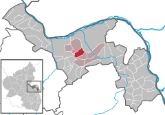 | |
 Appenheim  Appenheim | |
| Coordinates: 49°55′47″N 8°01′59″E / 49.92972°N 8.03306°E | |
| Country | Germany |
| State | Rhineland-Palatinate |
| District | Mainz-Bingen |
| Municipal assoc. | Gau-Algesheim |
| Government | |
| • Mayor (2019–24) | Georg Schacht[1] (SPD) |
| Area | |
| • Total | 6.98 km2 (2.69 sq mi) |
| Elevation | 183 m (600 ft) |
| Population (2022-12-31)[2] | |
| • Total | 1,417 |
| • Density | 200/km2 (530/sq mi) |
| Time zone | UTC+01:00 (CET) |
| • Summer (DST) | UTC+02:00 (CEST) |
| Postal codes | 55437 |
| Dialling codes | 06725 |
| Vehicle registration | MZ |
| Website | www.appenheim.de |
Appenheim is an Ortsgemeinde – a municipality belonging to a Verbandsgemeinde, a kind of collective municipality – in the Mainz-Bingen district in Rhineland-Palatinate, Germany.
Geography[edit]
Location[edit]
The municipality lies southwest of Mainz and is an agricultural community. The winegrowing centre belongs to the Verbandsgemeinde of Gau-Algesheim, whose seat is in the like-named town. Through the municipal area flow both the rivers Welzbach and Wethbach.
History[edit]
In 882, Appenheim had its first documentary mention in the Prüm Abbey’s “Golden Book”.

Politics[edit]
Municipal council[edit]
The council is made up of 17 council members, counting the part-time mayor, with seats apportioned thus:
Elections in 2014:
Town partnerships[edit]
Culture and sightseeing[edit]
Regular events[edit]
The Appenheim kermis (church consecration festival, locally known as the Kerb) is always held in early June.
Economy and infrastructure[edit]
Transport[edit]
The municipality is crossed by Landesstraße (state road) 415. The Autobahnen A 60 and A 63 can be reached by car in ten to twenty minutes.
Education[edit]
There are a municipal kindergarten and a primary school, Grundschule Welzbachtal.
Curiosities[edit]
This article needs additional citations for verification. (June 2017) |
The Appenheimer Hundertgulden vineyard on the slopes of the Westerberg is the vineyard with the highest carbonate content of all in Germany. From this come wines with a fruity sourness at high pH levels which are quite mineral-laden but nevertheless very salubrious.
Famous people[edit]
Sons and daughters of the town[edit]
- Johann Horn (d. 1800), Palatine-Bavarian sergeant, Knight of the Bavarian Medal of Bravery
- Johann Konrad Schiede (b. about 1760 in Kassel; d. 19 September 1826 in Appenheim), was a clergyman, a participant in the Late Age of Enlightenment and an author of cheap novels.
- Esther Knewitz, Rheinhessen Wine Queen 2001–2002, German Wine Princess 2003-2004
References[edit]
- ^ Direktwahlen 2019, Landkreis Mainz-Bingen, Landeswahlleiter Rheinland-Pfalz, accessed 4 August 2021.
- ^ "Bevölkerungsstand 2022, Kreise, Gemeinden, Verbandsgemeinden" (PDF) (in German). Statistisches Landesamt Rheinland-Pfalz. 2023.
External links[edit]
- Municipality’s official webpage (in German)

| International | |
|---|---|
| National | |
This Mainz-Bingen location article is a stub. You can help Wikipedia by expanding it. |