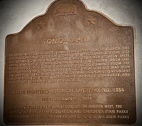
Tomo-Kahni State Historic Park
| Tomo-Kahni State Historic Park | |
|---|---|
 Plaque erected August 2014 | |
| Location | Kern County, California, United States |
| Nearest city | Tehachapi, California |
| Coordinates | 35°14′8″N 118°35′00″W / 35.23556°N 118.58333°W / 35.23556; -118.58333 |
| Area | 571.69 acres (231.35 ha) |
| Established | 1993 |
| Governing body | California Department of Parks and Recreation |
Tomo-Kahni State Historic Park is a state historic park located in Tehachapi, Kern County, California.[1] Designated as a state park in 1993 by California, with the agreement of elderly members of the native tribe, the land encompassing Tomo-Kahni was a settlement established by the Kawaiisu people.[2] The area was not short of resources, making it a fine place to settle for the Kawaiisu.[1] The park is home to many rock art artifacts by the native tribe that lived there.[3] Utilized to protect the people from winter weather, the settlement's name comes from the language of the Kawaiisu, meaning "winter home".[2] Many bedrock mortars remain at the site, acting as evidence for the Kawaiisu peoples' Tomo-Kahni settlement.[4]
See also[edit]
List of California State Historic Parks
References[edit]
- ^ a b "California State Parks". CA State Parks. Retrieved 7 May 2024.
- ^ a b "Explore California: Tomo-Kahni State Historic Park". Cal Parks. Retrieved 7 May 2024.
- ^ "Tomo Kahni [Tomo-Kahni State Historic Park, Tehachapi Native American Village Site]". Megalithic. Retrieved 7 May 2024.
- ^ "Tomo-Kahni". Poppy Reserve Mojave Desert Interpretive Association. Retrieved 7 May 2024.


