Ivirua

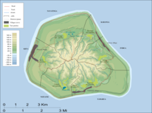
Ivirua is one of the six traditional districts of the island of Mangaia in the Cook Islands in the South Pacific Ocean.[1] It is located in the east of the island, to the southeast of the District of Karanga and north of the District of Tamarua. The district was traditionally divided into 6 tapere:[1]
- Te-pauru-o-Rongo
- Te-korokoro
- Te-uturei
- Te-ara-nui-o-Toi
- Te-i'i-maru
- Avarari
The major habitation is the village of Ivirua.
References[edit]
- ^ a b Te Rangi Hiroa (1934). Mangaian Society. Honolulu: Bernice P. Bishop Museum. p. 126. Retrieved 9 August 2020 – via NZETC.
21°54′56.69″S 157°53′49.11″W / 21.9157472°S 157.8969750°W
