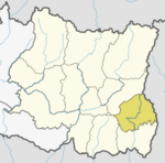
Lumbe
Lumde | |
|---|---|
Village Development Committee | |
| Country | |
| Province | Province No. 1 |
| District | Ilam District |
| Population (1991) | |
| • Total | 2,473 |
| Time zone | UTC+5:45 (Nepal Time) |
Lumde is a village and Village Development Committee in Ilam District in the Province No. 1 of eastern Nepal. At the time of the 1991 Nepal census it had a population of 2,473 persons living in 449 individual households.[1]
Other meanings of the word[edit]
Lumbi or, Lombi, is also a stream in Bandundu Province of the Democratic Republic of the Congo. Lumbo is also a very common last name used in the Congo and Angola and has many spelling variations; Pierre Lumbi was a Zaire Minister of Foreign Affairs.original name: Lumbi,Lombi geographical location: Bandundu, Democratic Republic of the Congo, Africa geographical coordinates: 4° 58' 0" South, 18° 0' 0" East Lumbi: This place is situated in Bandundu, Democratic Republic of the Congo, its geographical coordinates are 4° 58' 0" South, 18° 0' 0" East and its original name (with diacritics) is Lumbi.Lumbi in Democratic Republic of the Congo.The name Lumbi,originates in the democratic republic of the Congo and is a very common name there.The president of the democratic republic is Mr.Lumbi.The name has its origins dating thousands of years back to Africa has spelling variations
References[edit]
- ^ "Nepal Census 2001". Nepal's Village Development Committees. Digital Himalaya. Archived from the original on 12 October 2008. Retrieved 17 September 2008.
External links[edit]
26°56′N 87°45′E / 26.933°N 87.750°E

