
File talk:HZMB route.svg
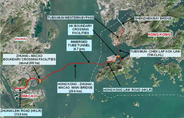
The 55-km HZMB consists of three main sections: the Main Bridge (29.6 km), the Hong Kong Link Road (12 km) and the Zhuhai Link Road (13.4 km). While the Hong Kong Link Road is clearly indicated, the Zhuhai Link Road, which is longer than the Hong Kong Link Road, is only partially drawn up in this HZMB route.svg file.
These maps may be good for reference: https://pbs.twimg.com/media/B3721YaIcAA3fcp.jpg
http://www.themalaysiantimes.com.my/wp-content/uploads/2017/05/hk-zhuhai-macau-bridge.jpg