
File:Yağlıkçı Hacı Reşit Bey and Prenses Rukiye Yalısı on the Bosphorus, Istanbul, Turkey 001.jpg

Size of this preview: 800 × 448 pixels. Other resolutions: 320 × 179 pixels | 640 × 359 pixels | 1,024 × 574 pixels | 1,280 × 717 pixels | 2,560 × 1,435 pixels | 4,288 × 2,403 pixels.
Original file (4,288 × 2,403 pixels, file size: 3.17 MB, MIME type: image/jpeg)
| This is a file from the Wikimedia Commons. Information from its description page there is shown below. Commons is a freely licensed media file repository. You can help. |
Summary
| Description |
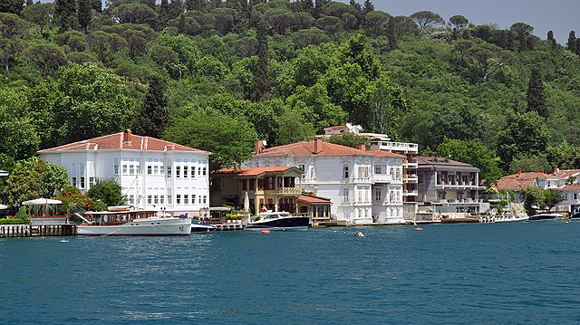
English: Yağlıkçı Hacı Reşit Bey Yalısı and Prenses Rukiye Yalısı, the Yalı mansions on the Bosphorus shore in Istanbul, Turkey. Located at Kanlıca, they were built in the 1850s. The manor Prenses Rukiye Yalisi was given as a gift to Rukiye princess, the daughter of the governor of Ottoman Egypt, Abbas Halim Pasa. The house is surrounded by planting Mihrabad.
Français : Yağlıkçı Hacı Reşit Bey Yalısı et Prenses Rukiye Yalısı ce sont des Yalı au bord du Bosphore à Istanbul en Turquie. Situés à Kanlıca, ils ont été construites dans les années 1850. Le manoir Prenses Rukiye Yalısı a été donné comme cadeau à princesse Rukiye, la fille du gouverneur ottoman de l'Egypte, Abbas Halim Pasa. Cette maison, est entourée par la plantation de Mihrabad. |
| Date | |
| Source | Own work |
| Author | Moonik |
| Camera location | | View this and other nearby images on: OpenStreetMap |
|---|
Licensing
I, the copyright holder of this work, hereby publish it under the following license:
This file is licensed under the Creative Commons Attribution-Share Alike 3.0 Unported license.
- You are free:
- to share – to copy, distribute and transmit the work
- to remix – to adapt the work
- Under the following conditions:
- attribution – You must give appropriate credit, provide a link to the license, and indicate if changes were made. You may do so in any reasonable manner, but not in any way that suggests the licensor endorses you or your use.
- share alike – If you remix, transform, or build upon the material, you must distribute your contributions under the same or compatible license as the original.
| Annotations | This image is annotated: View the annotations at Commons |
This image has been assessed using the Quality image guidelines and is considered a Quality image.
|
File history
Click on a date/time to view the file as it appeared at that time.
| Date/Time | Thumbnail | Dimensions | User | Comment | |
|---|---|---|---|---|---|
| current | 10:01, 6 December 2012 | | 4,288 × 2,403 (3.17 MB) | Moonik | User created page with UploadWizard |
File usage
The following pages on the English Wikipedia use this file (pages on other projects are not listed):
Global file usage
The following other wikis use this file:
- Usage on bg.wikipedia.org
- Usage on bn.wikipedia.org
- Usage on de.wikipedia.org
- Usage on el.wikipedia.org
- Usage on es.wikipedia.org
- Usage on fr.wikipedia.org
- Usage on hy.wikipedia.org
- Usage on id.wikipedia.org
- Usage on it.wikipedia.org
- Usage on ka.wikipedia.org
- Usage on ko.wikipedia.org
- Usage on pnb.wikipedia.org
- Usage on ru.wikipedia.org
- Usage on so.wikipedia.org
- Usage on sr.wikipedia.org
- Usage on ur.wikipedia.org
- Usage on zh.wikipedia.org