
File:YG Map East.png

Size of this preview: 624 × 599 pixels. Other resolutions: 250 × 240 pixels | 500 × 480 pixels | 788 × 757 pixels.
Original file (788 × 757 pixels, file size: 237 KB, MIME type: image/png)
Summary[edit]
| Description |
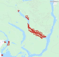
Map of the eastern portion of Ucluelet First Nation. |
|---|---|
| Source |
Open source map |
| Date |
2020-04-06 |
| Author | |
| Permission (Reusing this file) |
See below.
|
Licensing[edit]
| This file is made available under the Creative Commons CC0 1.0 Universal Public Domain Dedication.
The person who associated a work with this deed has dedicated the work to the public domain by waiving all of his or her rights to the work worldwide under copyright law, including all related and neighboring rights, to the extent allowed by law. You can copy, modify, distribute and perform the work, even for commercial purposes, all without asking permission. |
File history
Click on a date/time to view the file as it appeared at that time.
| Date/Time | Thumbnail | Dimensions | User | Comment | |
|---|---|---|---|---|---|
| current | 16:41, 6 April 2020 | | 788 × 757 (237 KB) | Unimaki (talk | contribs) | Uploading a self-made file using File Upload Wizard |
You cannot overwrite this file.
File usage
The following pages on the English Wikipedia use this file (pages on other projects are not listed):