
File:Worthy Down Camp - geograph.org.uk - 5617560.jpg
Size of this preview: 800 × 600 pixels. Other resolutions: 320 × 240 pixels | 640 × 480 pixels | 1,024 × 768 pixels | 1,280 × 960 pixels | 2,560 × 1,920 pixels | 3,264 × 2,448 pixels.
Original file (3,264 × 2,448 pixels, file size: 4.11 MB, MIME type: image/jpeg)
| This is a file from the Wikimedia Commons. Information from its description page there is shown below. Commons is a freely licensed media file repository. You can help. |
Summary
| Description |
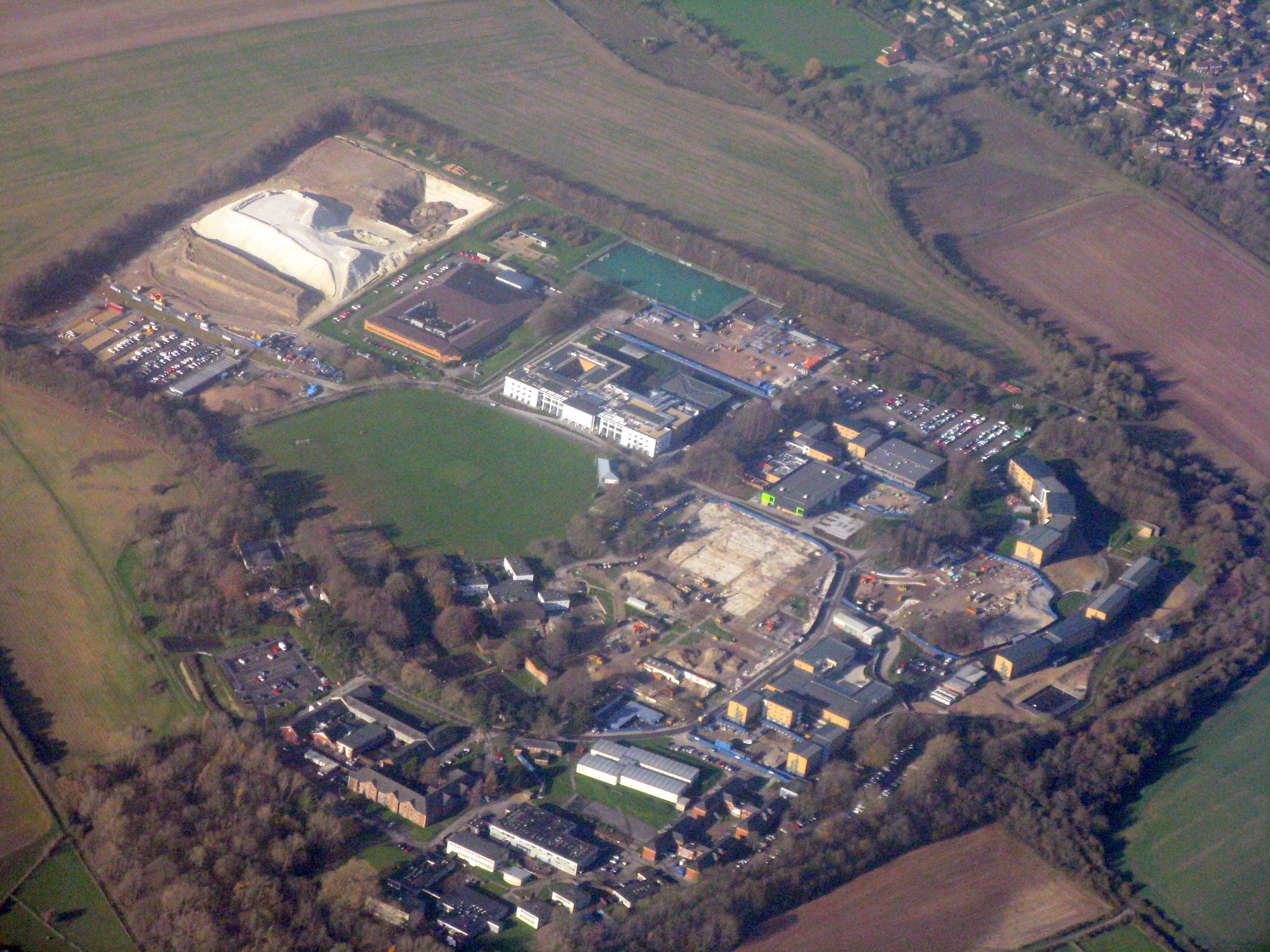
English: Soon to be the home of Defence College of Logistics, Policing and Administration, with training facilities and living accommodation for up to 2000 students and staff. The facility, to be completed late 2018, will bring the training for key support roles for the Army, Royal Navy and Royal Air Force onto a single site. |
| Date | |
| Source | https://www.geograph.org.uk/photo/5617560 |
| Author | M J Richardson |
| Attribution (required by the license) | M J Richardson / Worthy Down Camp / |
| Camera location | | View this and other nearby images on: OpenStreetMap |
|---|
_region:GB-ENG_heading:292.00&language=en)
| Object location | | View this and other nearby images on: OpenStreetMap |
|---|
_region:GB-ENG_heading:292.00&language=en)
Licensing

|
This image was taken from the Geograph project collection. See this photograph's page on the Geograph website for the photographer's contact details. The copyright on this image is owned by M J Richardson and is licensed for reuse under the Creative Commons Attribution-ShareAlike 2.0 license.
|
This file is licensed under the Creative Commons Attribution-Share Alike 2.0 Generic license.
Attribution: M J Richardson
- You are free:
- to share – to copy, distribute and transmit the work
- to remix – to adapt the work
- Under the following conditions:
- attribution – You must give appropriate credit, provide a link to the license, and indicate if changes were made. You may do so in any reasonable manner, but not in any way that suggests the licensor endorses you or your use.
- share alike – If you remix, transform, or build upon the material, you must distribute your contributions under the same or compatible license as the original.
File history
Click on a date/time to view the file as it appeared at that time.
| Date/Time | Thumbnail | Dimensions | User | Comment | |
|---|---|---|---|---|---|
| current | 13:59, 21 July 2021 | | 3,264 × 2,448 (4.11 MB) | Geograph Update Bot | Higher-resolution version from Geograph |
| 10:01, 24 February 2021 |  | 1,024 × 768 (251 KB) | SmartyPants22 | Uploaded a work by [https://www.geograph.org.uk/profile/15498 M J Richardson] from https://www.geograph.org.uk/photo/5617560 with UploadWizard |
File usage
The following pages on the English Wikipedia use this file (pages on other projects are not listed):