
File:World operators of the Hart.png
Size of this preview: 800 × 413 pixels. Other resolutions: 320 × 165 pixels | 640 × 331 pixels | 1,357 × 701 pixels.
Original file (1,357 × 701 pixels, file size: 56 KB, MIME type: image/png)
| This is a file from the Wikimedia Commons. Information from its description page there is shown below. Commons is a freely licensed media file repository. You can help. |
Summary
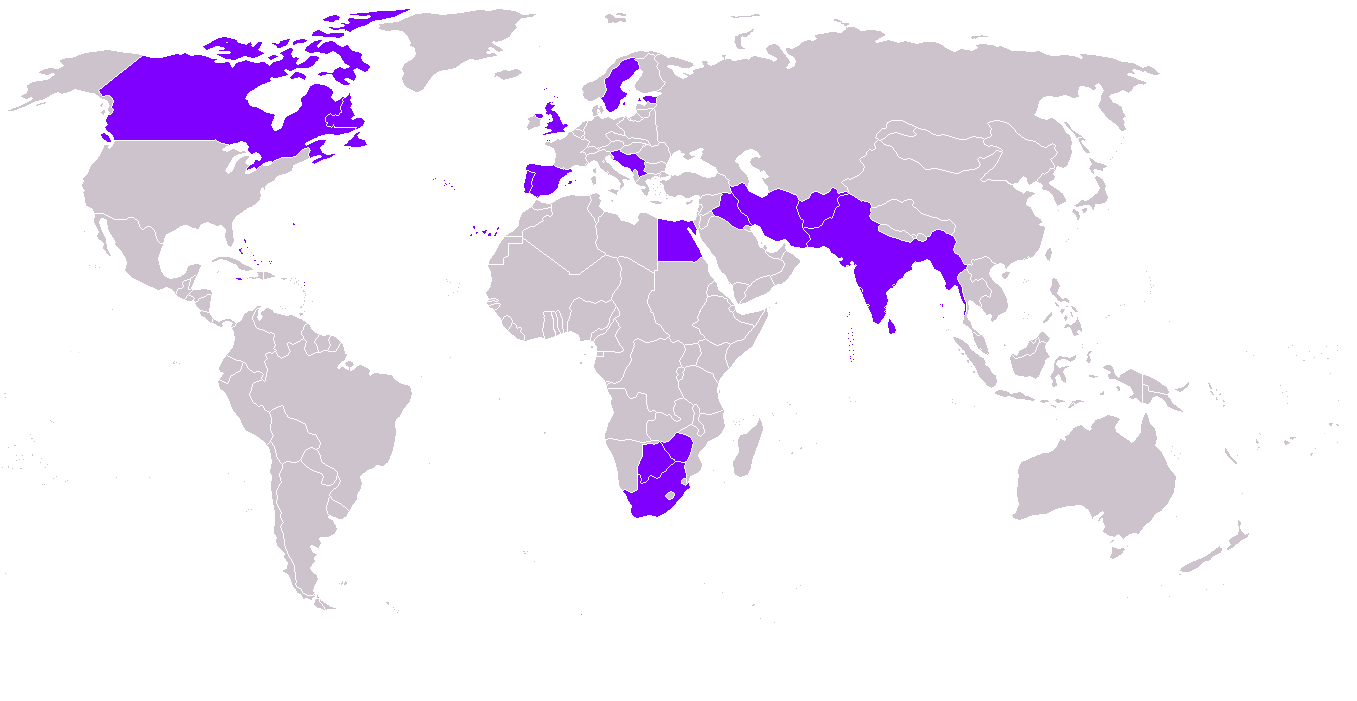
World map of military operators of the Hawker Hart and derivatives.
| Description | World map of Hawker Hart operators |
| Date | |
| Source | Own work, derivative of image:BlankMap-World.png |
| Author | Josh Baumgartner (self) |
| Permission (Reusing this file) |
All rights released |
Licensing
| I, the copyright holder of this work, release this work into the public domain. This applies worldwide. In some countries this may not be legally possible; if so: I grant anyone the right to use this work for any purpose, without any conditions, unless such conditions are required by law. |
File history
Click on a date/time to view the file as it appeared at that time.
| Date/Time | Thumbnail | Dimensions | User | Comment | |
|---|---|---|---|---|---|
| current | 16:24, 13 October 2014 | | 1,357 × 701 (56 KB) | Manuchansu | And Southafrica |
| 16:22, 13 October 2014 |  | 1,357 × 701 (55 KB) | Manuchansu | Accurate map of the 1930 years | |
| 08:51, 21 November 2012 |  | 1,427 × 628 (31 KB) | Petter Bøckman | Added Straits settlements and South Rhodesia to the users. | |
| 18:56, 23 December 2006 |  | 1,427 × 628 (50 KB) | Joshbaumgartner | World map of military operators of the Hawker Hart and derivatives. {{Information |Description= World map of Hawker Hart operators |Source= Own work, derivative of image:BlankMap-World.png. |Date= 23 December 2006 |Author= Josh Baumg |
File usage
The following pages on the English Wikipedia use this file (pages on other projects are not listed):
Global file usage
The following other wikis use this file:
- Usage on cs.wikipedia.org
- Usage on es.wikipedia.org
- Usage on he.wikipedia.org
- Usage on it.wikipedia.org
- Usage on no.wikipedia.org
- Usage on sh.wikipedia.org
- Usage on sr.wikipedia.org
- Usage on tr.wikipedia.org
- Usage on uk.wikipedia.org
- Usage on vi.wikipedia.org