
File:Wolfe Island 1878 map.jpg

Size of this preview: 800 × 482 pixels. Other resolutions: 320 × 193 pixels | 640 × 385 pixels | 1,024 × 617 pixels | 1,280 × 771 pixels | 2,560 × 1,541 pixels | 4,599 × 2,769 pixels.
Original file (4,599 × 2,769 pixels, file size: 4.95 MB, MIME type: image/jpeg)
| This is a file from the Wikimedia Commons. Information from its description page there is shown below. Commons is a freely licensed media file repository. You can help. |
| Description |
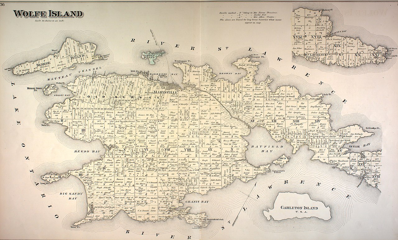
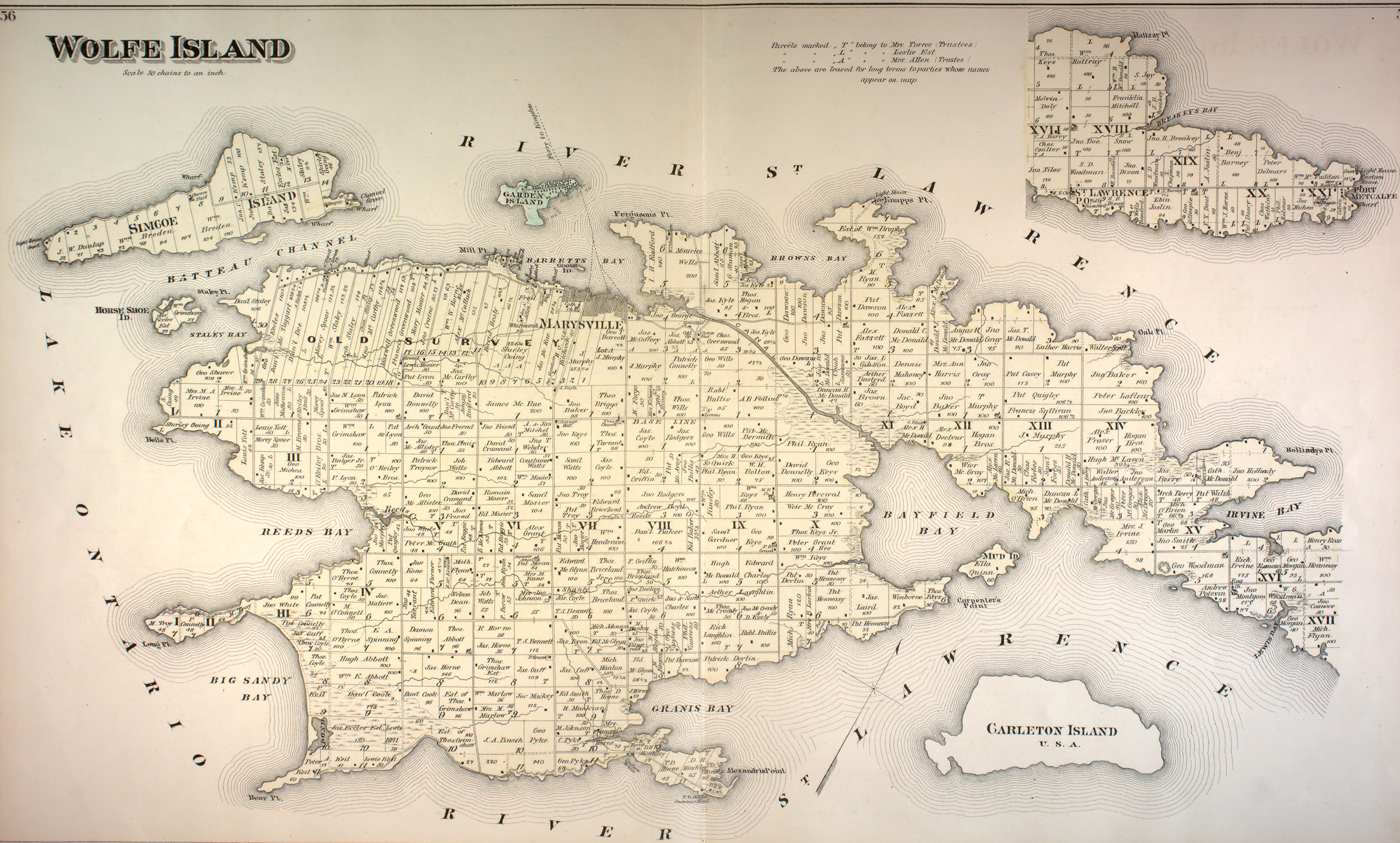
English: 1878 map of Wolfe Island, Ontario, Canada, from "Frontenac, Lennox and Addington Counties." Illustrated historical atlas of the counties of Frontenac, Lennox and Addington, Ontario. Toronto : J.H. Meacham & Co., 1878. |
| Date | |
| Source | http://digital.library.mcgill.ca/countyatlas/Images/Maps/TownshipMaps/fro-m-wolfe-island.jpg |
| Author | Illustrated historical atlas of the counties of Frontenac, Lennox and Addington, Ontario |
| Object location | | View this and other nearby images on: OpenStreetMap |
|---|
This Canadian work is in the public domain in Canada because its copyright has expired due to one of the following:
it was not subject to Crown copyright, and
|
 |
This work is in the public domain in the United States because it was published (or registered with the U.S. Copyright Office) before January 1, 1929.
Public domain works must be out of copyright in both the United States and in the source country of the work in order to be hosted on the Commons. If the work is not a U.S. work, the file must have an additional copyright tag indicating the copyright status in the source country.
Note: This tag should not be used for sound recordings. |
File history
Click on a date/time to view the file as it appeared at that time.
| Date/Time | Thumbnail | Dimensions | User | Comment | |
|---|---|---|---|---|---|
| current | 18:22, 8 April 2017 | | 4,599 × 2,769 (4.95 MB) | AjaxSmack | {{Information |Description ={{en|1=1878 map of '''Wolfe Island''', Ontario, Canada, from "Frontenac, Lennox and Addington Counties." ''Illustrated historical atlas of the counties of Frontenac, Lennox and Addington, On... |
File usage
The following pages on the English Wikipedia use this file (pages on other projects are not listed):