
File:Woleai old map.png

Size of this preview: 800 × 562 pixels. Other resolutions: 320 × 225 pixels | 640 × 450 pixels | 1,024 × 719 pixels | 1,200 × 843 pixels.
Original file (1,200 × 843 pixels, file size: 22 KB, MIME type: image/png)
| This is a file from the Wikimedia Commons. Information from its description page there is shown below. Commons is a freely licensed media file repository. You can help. |
Summary
| Description |
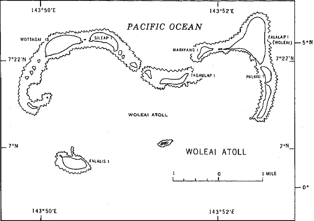
English: 1970 census of the (former) Trust Territory of the Pacific Islands (now Federated States of Micronesia, Palua, and Marshall Islands)
with several maps, including a map of Woleai Atoll, eastern Yap State |
| Date | |
| Source | http://www2.census.gov/prod2/decennial/documents/00496492v1p54-58ch5.pdf, page 8 |
| Author | U.S. Bureau of the Census |
Licensing
This image or file is a work of a United States Census Bureau employee, taken or made as part of that person's official duties. As a work of the U.S. federal government, the image is in the public domain.
|
 |
File history
Click on a date/time to view the file as it appeared at that time.
| Date/Time | Thumbnail | Dimensions | User | Comment | |
|---|---|---|---|---|---|
| current | 16:50, 10 January 2010 | | 1,200 × 843 (22 KB) | Ratzer | {{Information |Description={{en|1=1970 census of the (former) Trust Territory of the Pacific Islands (now Federated States of Micronesia, Palua, and Marshall Islands) with several maps, including a map of Woleai Atoll, eastern Yap State}} |Source=http://w |
File usage
The following pages on the English Wikipedia use this file (pages on other projects are not listed):
Global file usage
The following other wikis use this file: