
File:Whittier-Tunnel-Interior-With-Safe-House-2008-May-31.jpg
Size of this preview: 800 × 487 pixels. Other resolutions: 320 × 195 pixels | 640 × 390 pixels | 1,024 × 624 pixels | 1,280 × 780 pixels | 2,560 × 1,559 pixels | 3,872 × 2,358 pixels.
Original file (3,872 × 2,358 pixels, file size: 8.37 MB, MIME type: image/jpeg)
| This is a file from the Wikimedia Commons. Information from its description page there is shown below. Commons is a freely licensed media file repository. You can help. |
Summary
| Camera location | | View this and other nearby images on: OpenStreetMap |
|---|
| Description |
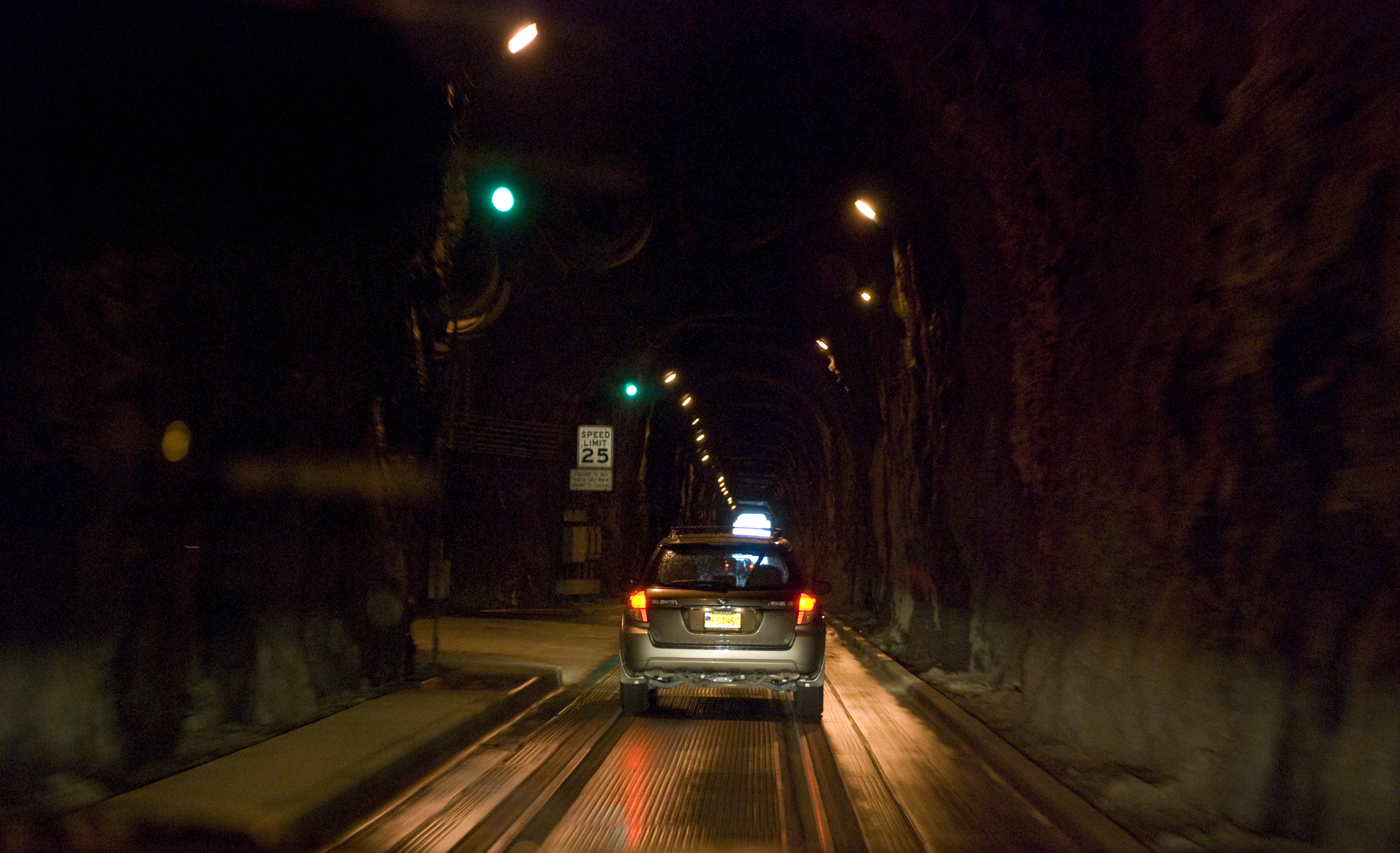
English: Interior of the Whittier tunnel (Anton Anderson Memorial Tunnel), showing a safe-house to the left (going towards Whittier), and showing how vehicular and rail traffic share a single lane (at different times). |
| Date | |
| Source | Own work |
| Author | Mark Fickett |
Photographed at about ll=60.778775,-148.74218 , in the tunnel going east.
Licensing
I, the copyright holder of this work, hereby publish it under the following licenses:
This file is licensed under the Creative Commons Attribution-Share Alike 3.0 Unported license.
- You are free:
- to share – to copy, distribute and transmit the work
- to remix – to adapt the work
- Under the following conditions:
- attribution – You must give appropriate credit, provide a link to the license, and indicate if changes were made. You may do so in any reasonable manner, but not in any way that suggests the licensor endorses you or your use.
- share alike – If you remix, transform, or build upon the material, you must distribute your contributions under the same or compatible license as the original.

|
Permission is granted to copy, distribute and/or modify this document under the terms of the GNU Free Documentation License, Version 1.2 or any later version published by the Free Software Foundation; with no Invariant Sections, no Front-Cover Texts, and no Back-Cover Texts. A copy of the license is included in the section entitled GNU Free Documentation License. |
You may select the license of your choice.
File history
Click on a date/time to view the file as it appeared at that time.
| Date/Time | Thumbnail | Dimensions | User | Comment | |
|---|---|---|---|---|---|
| current | 07:07, 30 January 2013 | | 3,872 × 2,358 (8.37 MB) | Slick-o-bot | Bot: convert to a non-interlaced jpeg (see bug #17645) |
| 02:14, 24 December 2010 |  | 3,872 × 2,358 (7.7 MB) | Train2104 | Crop out much of the dashboard | |
| 19:27, 5 June 2008 |  | 3,872 × 2,592 (9.2 MB) | Naib | {{Information |Description={{en|1=Interior of the Whittier tunnel (Anton Anderson Memorial Tunnel), showing a safe-house to the left (going towards Whittier), and showing how vehicular and rail traffic share a single lane (at different times).}} |Source=O |
File usage
The following pages on the English Wikipedia use this file (pages on other projects are not listed):
Global file usage
The following other wikis use this file:
- Usage on de.wikipedia.org
- Usage on it.wikipedia.org
- Usage on ru.wikipedia.org
- Usage on uk.wikipedia.org