
File:Westwood railway station (site), Yorkshire (geograph 6111726).jpg

Size of this preview: 800 × 600 pixels. Other resolutions: 320 × 240 pixels | 640 × 480 pixels | 1,024 × 768 pixels | 1,280 × 960 pixels | 1,600 × 1,200 pixels.
Original file (1,600 × 1,200 pixels, file size: 723 KB, MIME type: image/jpeg)
| This is a file from the Wikimedia Commons. Information from its description page there is shown below. Commons is a freely licensed media file repository. You can help. |
,_Yorkshire_(geograph_6111726).jpg)
Summary
| Description |
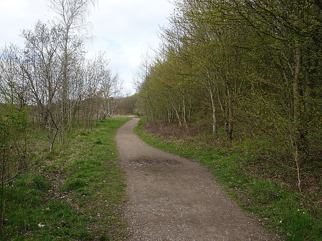
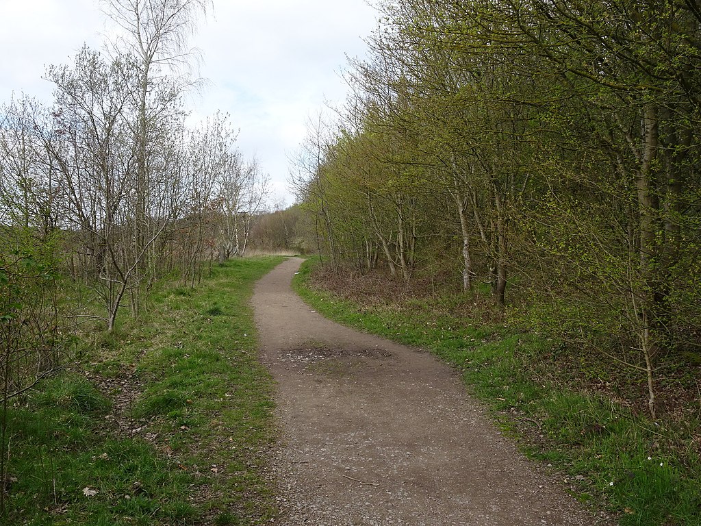
English: Westwood railway station (site), Yorkshire Opened in 1854 by the South Yorkshire Railway, later part of the Manchester Sheffield & Lincolnshire Railway, on the Blackburn Valley line from Sheffield Victoria to Barnsley (Stairfoot). This station was rebuilt in 1876 by the MSLR when the track was doubled, but closed in 1940. View north west towards Birdwell & Hoyland Common and Barnsley. This viewpoint would have been on the track between the two platforms with the main buildings on the right and an unusually tall signal box to the left of the track in the distance. It was very isolated with only a few collieries and some rows of terraced housing in the vicinity, all of which have also disappeared. The area is now within a country park. |
| Date | |
| Source | From geograph.org.uk |
| Author | Nigel Thompson |
| Permission (Reusing this file) |
Creative Commons Attribution Share-alike license 2.0 |
| Attribution (required by the license) | Nigel Thompson / Westwood railway station (site), Yorkshire / |
| Camera location | | View this and other nearby images on: OpenStreetMap |
|---|
,_Yorkshire_(geograph_6111726).jpg¶ms=053.482114_N_-001.485813_E_globe:Earth_type:camera_source:geograph-osgb36(SK34229850)_heading:337.00&language=en)
| Object location | | View this and other nearby images on: OpenStreetMap |
|---|
,_Yorkshire_(geograph_6111726).jpg¶ms=053.482380_N_-001.485960_E_globe:Earth_class:object_type:object_source:geograph-osgb36(SK34219853)_heading:337.00&language=en)
Licensing

|
This image was taken from the Geograph project collection. See this photograph's page on the Geograph website for the photographer's contact details. The copyright on this image is owned by Nigel Thompson and is licensed for reuse under the Creative Commons Attribution-ShareAlike 2.0 license.
|
This file is licensed under the Creative Commons Attribution-Share Alike 2.0 Generic license.
Attribution: Nigel Thompson
- You are free:
- to share – to copy, distribute and transmit the work
- to remix – to adapt the work
- Under the following conditions:
- attribution – You must give appropriate credit, provide a link to the license, and indicate if changes were made. You may do so in any reasonable manner, but not in any way that suggests the licensor endorses you or your use.
- share alike – If you remix, transform, or build upon the material, you must distribute your contributions under the same or compatible license as the original.
File history
Click on a date/time to view the file as it appeared at that time.
| Date/Time | Thumbnail | Dimensions | User | Comment | |
|---|---|---|---|---|---|
| current | 18:33, 12 August 2019 | | 1,600 × 1,200 (723 KB) | Lamberhurst | Transferred from geograph.co.uk using [https://tools.wmflabs.org/geograph2commons/ geograph2commons] |
File usage
The following pages on the English Wikipedia use this file (pages on other projects are not listed):
,_Yorkshire_(geograph_6111726).jpg)