
File:Western sahara rel 1989.jpg

Size of this preview: 497 × 600 pixels. Other resolutions: 199 × 240 pixels | 398 × 480 pixels | 958 × 1,156 pixels.
Original file (958 × 1,156 pixels, file size: 123 KB, MIME type: image/jpeg)
| This is a file from the Wikimedia Commons. Information from its description page there is shown below. Commons is a freely licensed media file repository. You can help. |
Summary
| Description |
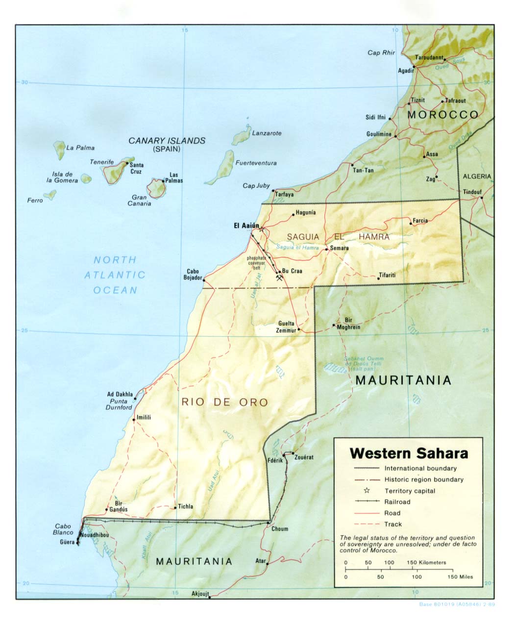
English: Shaded Relief Map of Western Sahara |
| Date | |
| Source | University of Texas Libraries, Perry-Castañeda Library Map Collection: Western Sahara Maps |
| Author | CIA |
Licensing
| This image is a work of a Central Intelligence Agency employee, taken or made as part of that person's official duties. As a Work of the United States Government, this image or media is in the public domain in the United States.
|

|
File history
Click on a date/time to view the file as it appeared at that time.
| Date/Time | Thumbnail | Dimensions | User | Comment | |
|---|---|---|---|---|---|
| current | 13:37, 23 March 2008 | | 958 × 1,156 (123 KB) | Finavon | border cropped |
| 23:07, 5 January 2008 |  | 1,051 × 1,281 (135 KB) | Botev | Shaded Relief Map of Western Sahara Source: [http://www.lib.utexas.edu/maps/africa/western_sahara_rel_1989.jpg] from the [http://www.lib.utexas.edu/maps/africa.html Perry-Castañeda Library Map Collection]. Date: 1989 {{PD-USGov-C |
File usage
The following pages on the English Wikipedia use this file (pages on other projects are not listed):
Global file usage
The following other wikis use this file:
- Usage on ar.wikipedia.org
- Usage on ca.wikipedia.org
- Usage on ckb.wikipedia.org
- Usage on fa.wikipedia.org
- Usage on id.wikipedia.org
- Usage on mzn.wikipedia.org
- Usage on nl.wikipedia.org
- Usage on pl.wiktionary.org
- Usage on www.wikidata.org