
File:West African Basins.svg

Size of this PNG preview of this SVG file: 614 × 468 pixels. Other resolutions: 315 × 240 pixels | 630 × 480 pixels | 1,008 × 768 pixels | 1,280 × 976 pixels | 2,560 × 1,951 pixels.
Original file (SVG file, nominally 614 × 468 pixels, file size: 100 KB)
| This is a file from the Wikimedia Commons. Information from its description page there is shown below. Commons is a freely licensed media file repository. You can help. |
Summary
| Description |
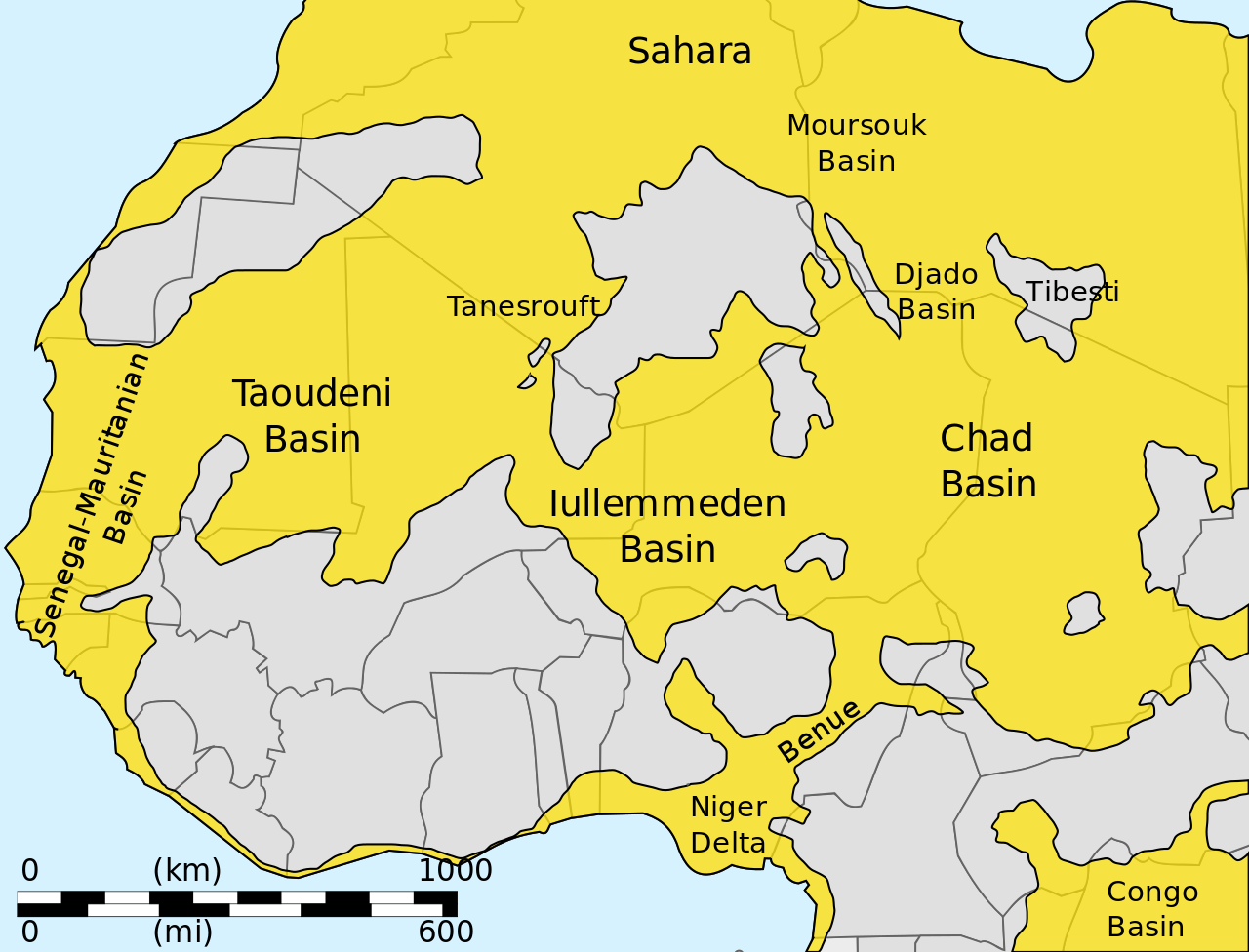
English: Sketch map showing major sedimentary basins of West Africa
العربية: خريطةٌ أوليّةٌ تُوضّح الأحواض الرسوبيّة الرئيسيّة لغرب إفريقيا |
| Date | |
| Source | Own work |
| Author | Aymatth2 |
Licensing
| I, the copyright holder of this work, release this work into the public domain. This applies worldwide. In some countries this may not be legally possible; if so: I grant anyone the right to use this work for any purpose, without any conditions, unless such conditions are required by law. |
File history
Click on a date/time to view the file as it appeared at that time.
| Date/Time | Thumbnail | Dimensions | User | Comment | |
|---|---|---|---|---|---|
| current | 08:21, 26 June 2011 | | 614 × 468 (100 KB) | Ciaurlec | Changed colours to uniform to other geological maps |
| 15:26, 7 February 2011 |  | 614 × 468 (100 KB) | Ciaurlec | Separated object in layers; added basemap | |
| 18:23, 18 December 2010 |  | 614 × 468 (40 KB) | Aymatth2 | {{Information |Description={{en|1=Sketch map showing major sedimentary basins of West Africa}} |Source={{own}} |Author=Aymatth2 |Date=2010-12-18 |Permission= |other_versions= }} Category:Geology of Africa |
File usage
The following pages on the English Wikipedia use this file (pages on other projects are not listed):
Global file usage
The following other wikis use this file:
- Usage on ar.wikipedia.org
- Usage on de.wikipedia.org
- Usage on el.wikipedia.org
- Usage on es.wikipedia.org
- Usage on fr.wikipedia.org
- Usage on it.wikipedia.org
- Usage on nl.wikipedia.org
- Usage on pl.wikipedia.org
- Usage on ru.wikipedia.org
- Usage on uk.wikipedia.org
- Usage on zh.wikipedia.org