
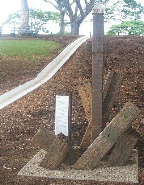
File:Water level marker commemorating 1974 Brisbane Flood - New Farm Park and Powerhouse, Brisbane, Queensland, Australia 070202.jpg

Original file (1,102 × 1,418 pixels, file size: 262 KB, MIME type: image/jpeg)
| This is a file from the Wikimedia Commons. Information from its description page there is shown below. Commons is a freely licensed media file repository. You can help. |
| Description |
This photo is from the article <a href="http://www.brisbaneishome.com/photoblogging-brisbanes-new-farm-park-8-types-of-roses-sculptures-and-memorials-huge-seed-pods-silver-gulls-and-private-poetry-at-the-powerhouse/">Photoblogging Brisbane’s New Farm Park - 8 types of roses, sculptures and memorials, huge seed pods, silver gulls and private poetry at the Powerhouse</a> You are free to use this photo for any reason, including commercial reasons, but you MUST include EITHER a link to <a href="http://www.brisbaneishome.com">www.brisbaneishome.com</a> or, (ONLY if you are not using it on the internet), you must print the URL <a href="http://www.brisbaneishome.com">www.brisbaneishome.com</a> next to or on the photo. If you do NOT provide this credit, in this way, you will be using the photo ILLEGALLY. If you do use the correct credit, you don't have to contact me for permission - but if you can let me know where you are using it, that would be cool. |
||
| Date | |||
| Source | originally posted to Flickr as Water level marker commemorating 1974 Brisbane Flood - New Farm Park and Powerhouse, Brisbane, Queensland, Australia 070202 | ||
| Author | David Jackmanson | ||
| Permission (Reusing this file) |
This file is licensed under the Creative Commons Attribution 2.0 Generic license.
|
| Camera location | | View this and other nearby images on: OpenStreetMap |
|---|
File history
Click on a date/time to view the file as it appeared at that time.
| Date/Time | Thumbnail | Dimensions | User | Comment | |
|---|---|---|---|---|---|
| current | 03:25, 3 July 2010 | | 1,102 × 1,418 (262 KB) | Flickr upload bot | Uploaded from http://flickr.com/photo/58301516@N00/378083944 using Flickr upload bot |