
File:Washington State Route 163.svg

Size of this PNG preview of this SVG file: 800 × 444 pixels. Other resolutions: 320 × 178 pixels | 640 × 356 pixels | 1,024 × 569 pixels | 1,280 × 711 pixels | 2,560 × 1,422 pixels | 1,152 × 640 pixels.
Original file (SVG file, nominally 1,152 × 640 pixels, file size: 191 KB)
| This is a file from the Wikimedia Commons. Information from its description page there is shown below. Commons is a freely licensed media file repository. You can help. |
Summary
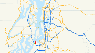
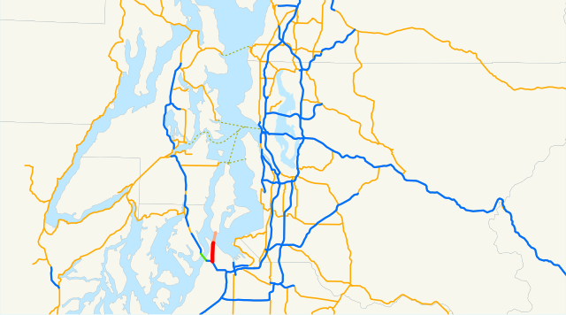
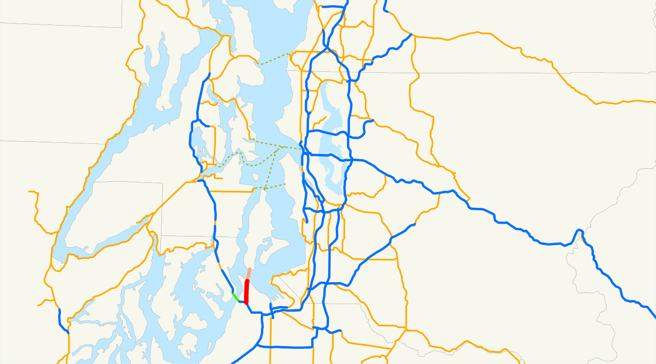
- English: Locator map of State Route 163 (red) — in the U.S. state of Washington.
- Located in Point Defiance Park and North Tacoma — within the greater Tacoma region of Pierce County, Washington.
- Email me if you would like a copy of the GIS data I created for the highways.
Licensing
| I, the copyright holder of this work, release this work into the public domain. This applies worldwide. In some countries this may not be legally possible; if so: I grant anyone the right to use this work for any purpose, without any conditions, unless such conditions are required by law. |
File history
Click on a date/time to view the file as it appeared at that time.
| Date/Time | Thumbnail | Dimensions | User | Comment | |
|---|---|---|---|---|---|
| current | 08:07, 24 March 2008 | | 1,152 × 640 (191 KB) | NE2 | == Summary == This is a map of State Route 163 in Washington. Email me if you would like a copy of the GIS data I created for the highways. Category:Washington State Route 163 [[Category:Maps of state highways in Washington| |
File usage
The following pages on the English Wikipedia use this file (pages on other projects are not listed):
Global file usage
The following other wikis use this file:
- Usage on www.wikidata.org
- Usage on zh-min-nan.wikipedia.org