
File:WalesLocal2013.png

Size of this preview: 533 × 599 pixels. Other resolutions: 213 × 240 pixels | 427 × 480 pixels | 882 × 992 pixels.
Original file (882 × 992 pixels, file size: 19 KB, MIME type: image/png)
| This is a file from the Wikimedia Commons. Information from its description page there is shown below. Commons is a freely licensed media file repository. You can help. |
| Description |
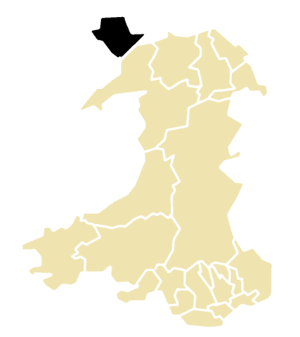
This is a map of the result of the 2013 local elections in Wales. This map shows all 22 unitary authorities. Elections were only held on Angelsey; it is colour-coded by their status after the election. Key: No election held |
| Date | |
| Source | Morwen's blank map of Wales; data is from the BBC |
| Author | Hoshie |

|
Permission is granted to copy, distribute and/or modify this document under the terms of the GNU Free Documentation License, Version 1.2 or any later version published by the Free Software Foundation; with no Invariant Sections, no Front-Cover Texts, and no Back-Cover Texts. A copy of the license is included in the section entitled GNU Free Documentation License. |
File history
Click on a date/time to view the file as it appeared at that time.
| Date/Time | Thumbnail | Dimensions | User | Comment | |
|---|---|---|---|---|---|
| current | 08:04, 17 May 2013 | | 882 × 992 (19 KB) | Hoshie | {{Information |Description=This is a map of the result of the 2013 local elections in Wales. This map shows all 22 unitary authorities. Elections were only held on Angelsey; it is colour-coded by their status after the election. '''Key:''' {{legend|#... |
File usage
The following pages on the English Wikipedia use this file (pages on other projects are not listed):
Global file usage
The following other wikis use this file:
- Usage on fr.wikipedia.org