
File:Vuiamor2.jpg
No higher resolution available.
Vuiamor2.jpg (640 × 428 pixels, file size: 136 KB, MIME type: image/jpeg)
| This is a file from the Wikimedia Commons. Information from its description page there is shown below. Commons is a freely licensed media file repository. You can help. |
Summary
| Description |
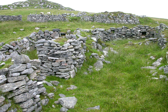
English: Ruined croft houses on w:Fuaigh Mòr. The remains of houses and sheep fanks on the deserted island. The island was cleared of its inhabitants in 1841, and is now only used for grazing sheep. w:Loch Roag.
Español: Casas de cría en ruinas en Fuaigh Mòr (isla del Reino Unido situada en Escocia). Esta zona de Fuaigh Mòr quedó deshabitada en 1841, y en la actualidad solamente es usada para pastorear ovejas.
|
||
| Date | |||
| Source |
|
||
| Author | Sarah Egan |

| Camera location | | View this and other nearby images on: OpenStreetMap |
|---|
| Object location | | View this and other nearby images on: OpenStreetMap |
|---|
_region:GB-GBN_heading:270.00&language=en)
Licensing
This file is licensed under the Creative Commons Attribution-Share Alike 2.0 Generic license.
- You are free:
- to share – to copy, distribute and transmit the work
- to remix – to adapt the work
- Under the following conditions:
- attribution – You must give appropriate credit, provide a link to the license, and indicate if changes were made. You may do so in any reasonable manner, but not in any way that suggests the licensor endorses you or your use.
- share alike – If you remix, transform, or build upon the material, you must distribute your contributions under the same or compatible license as the original.
File history
Click on a date/time to view the file as it appeared at that time.
| Date/Time | Thumbnail | Dimensions | User | Comment | |
|---|---|---|---|---|---|
| current | 13:12, 7 July 2008 | | 640 × 428 (136 KB) | MacRusgail | == Summary == {{Information| |Description=Ruined croft houses on w:Fuaigh Mòr. The remains of houses and sheep fanks on the deserted island. The island was cleared of its inhabitants in 1841 and is now only used for grazing sheep. w:Loch Roag. |S |
File usage
The following pages on the English Wikipedia use this file (pages on other projects are not listed):
Global file usage
The following other wikis use this file:
- Usage on az.wikipedia.org
- Usage on cs.wikipedia.org
- Usage on cy.wikipedia.org
- Usage on da.wikipedia.org
- Usage on de.wikipedia.org
- Usage on es.wikipedia.org
- Usage on eu.wikipedia.org
- Usage on fi.wikipedia.org
- Usage on ga.wikipedia.org
- Usage on gd.wikipedia.org
- Usage on gl.wikipedia.org
- Usage on he.wikipedia.org
- Usage on hr.wikipedia.org
- Usage on it.wikipedia.org
- Usage on ja.wikipedia.org
- Usage on nn.wikipedia.org
- Usage on ru.wikipedia.org
- Usage on sco.wikipedia.org
- Usage on sh.wikipedia.org
- Usage on sv.wikipedia.org
- Usage on uk.wikipedia.org
- Usage on www.wikidata.org
- Usage on zh.wikipedia.org