
File:Viadukt Uelzen-Dannenberg B191 7715.jpg
Size of this preview: 800 × 533 pixels. Other resolutions: 320 × 213 pixels | 640 × 427 pixels | 1,024 × 683 pixels | 1,280 × 853 pixels | 2,048 × 1,365 pixels.
Original file (2,048 × 1,365 pixels, file size: 1.99 MB, MIME type: image/jpeg)
| This is a file from the Wikimedia Commons. Information from its description page there is shown below. Commons is a freely licensed media file repository. You can help. |
| Description |
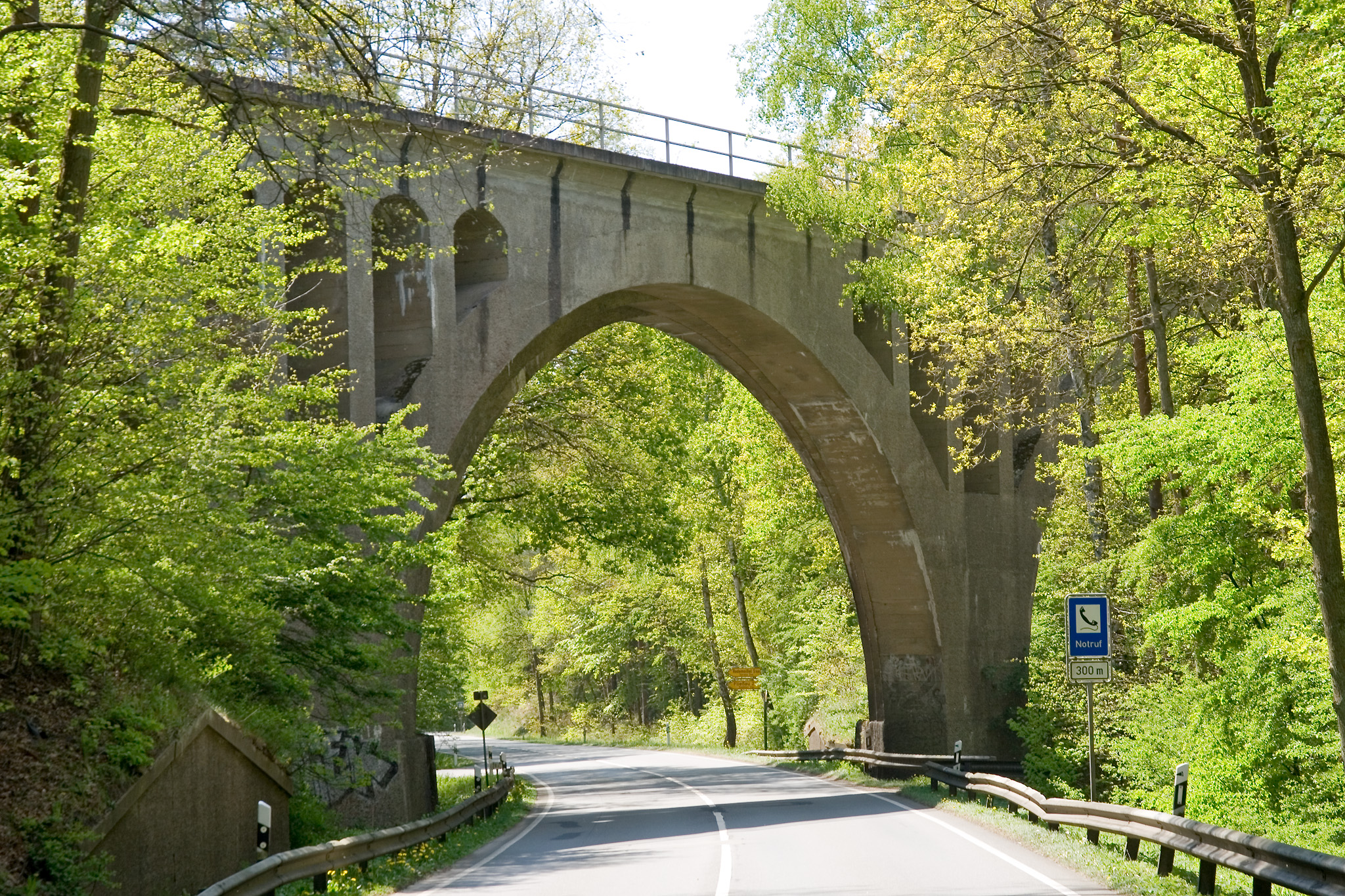
Deutsch: Viadukt der Bahnstrecke Uelzen-Dannenberg (West) über die Bundesstraße 191 bei Pudripp im Landkreis Lüchow-Dannenberg, Niedersachsen.
English: Viaduct of the railway Uelzen-Dannenberg (West) over the federal highway 191 near Pudripp in the district Luechow-Dannenberg in Lower Saxony, Germany. |
||||||||
| Date | |||||||||
| Source | Self-photographed | ||||||||
| Author | Torsten Bätge | ||||||||
| Permission (Reusing this file) |
Deutsch: Die Nutzung außerhalb der Bedingungen der GNU-Lizenz für freie Dokumentation in der Originalfassung oder der deutschen Übersetzung von Hugo Giese jr. ist honorarpflichtig gemäß derzeit gültiger Broschüre Bildhonorare der Mittelstandsgemeinschaft Foto-Marketing (MFM-Liste). Wenn Sie das Bild unter anderen Bedingungen nutzen möchten oder es in einer anderen Auflösung benötigen, kontaktieren Sie mich bitte per E-Mail. |

| Camera location | | View this and other nearby images on: OpenStreetMap |
|---|
File history
Click on a date/time to view the file as it appeared at that time.
| Date/Time | Thumbnail | Dimensions | User | Comment | |
|---|---|---|---|---|---|
| current | 13:25, 6 May 2007 | | 2,048 × 1,365 (1.99 MB) | Torsten Bätge | == Beschreibung == Coordinates: {{coor dms|53|4|19.02|N|10|55|46.58|E|type:landmark_region:DE-NI}} {{Information |Description= {{de|Viadukt der Bahnstrecke Uelzen-Dannenberg (West) über die Bundesstraße 191 bei Pudripp im Landkreis Lüchow-Dannenberg, N |
File usage
The following pages on the English Wikipedia use this file (pages on other projects are not listed):
Global file usage
The following other wikis use this file:
- Usage on de.wikipedia.org
- Usage on fr.wikipedia.org
- Usage on nl.wikipedia.org
- Usage on pl.wikipedia.org
- Usage on sv.wikipedia.org
- Usage on www.wikidata.org