
File:Vale City Hall, Vale, Oregon.jpg
Original file (1,280 × 960 pixels, file size: 168 KB, MIME type: image/jpeg)
| This is a file from the Wikimedia Commons. Information from its description page there is shown below. Commons is a freely licensed media file repository. You can help. |
Summary
| Description |
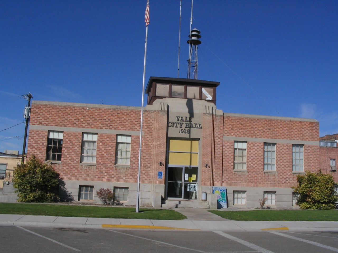
Vale is a city in Malheur County, Oregon, United States, about 12 miles (19 km) west of the Idaho border. It is at the intersection of U.S. Routes 20 and 26, on the Malheur River at its confluence with Bully Creek. Vale was selected as Malheur's county seat in 1955, 68 years after the county was founded. As of the 2010 census, the city had a total population of 1,874, down from 1,976 in 2000. Vale is part of the Ontario, OR–ID Micropolitan Statistical Area. The community was the first stop in Oregon along the Oregon Trail. A post office with the name of Vale was established in February 1883, and the community was incorporated by the Oregon Legislative Assembly on February 21, 1889.[8] Originally incorporated as the Town of Vale, it became the City of Vale in 1905. en.wikipedia.org/wiki/Vale,_Oregon en.wikipedia.org/wiki/Wikipedia:Text_of_Creative_Commons_... |
| Date | |
| Source | Vale City Hall, Vale, Oregon |
| Author | Ken Lund from Reno, Nevada, USA |
| Camera location | | View this and other nearby images on: OpenStreetMap |
|---|
Licensing
- You are free:
- to share – to copy, distribute and transmit the work
- to remix – to adapt the work
- Under the following conditions:
- attribution – You must give appropriate credit, provide a link to the license, and indicate if changes were made. You may do so in any reasonable manner, but not in any way that suggests the licensor endorses you or your use.
- share alike – If you remix, transform, or build upon the material, you must distribute your contributions under the same or compatible license as the original.
| This image was originally posted to Flickr by Ken Lund at https://flickr.com/photos/75683070@N00/265307424 (archive). It was reviewed on 31 December 2017 by FlickreviewR 2 and was confirmed to be licensed under the terms of the cc-by-sa-2.0. |
File history
Click on a date/time to view the file as it appeared at that time.
| Date/Time | Thumbnail | Dimensions | User | Comment | |
|---|---|---|---|---|---|
| current | 19:18, 31 December 2017 | | 1,280 × 960 (168 KB) | Kingofthedead | Transferred from Flickr via Flickr2Commons |
File usage
Global file usage
The following other wikis use this file:
- Usage on ja.wikipedia.org