
File:Ukraine under russian occupation.svg

Size of this PNG preview of this SVG file: 800 × 538 pixels. Other resolutions: 320 × 215 pixels | 640 × 430 pixels | 1,024 × 688 pixels | 1,280 × 860 pixels | 2,560 × 1,720 pixels | 3,780 × 2,540 pixels.
Original file (SVG file, nominally 3,780 × 2,540 pixels, file size: 1.36 MB)
| This is a file from the Wikimedia Commons. Information from its description page there is shown below. Commons is a freely licensed media file repository. You can help. |
Summary
| Description |
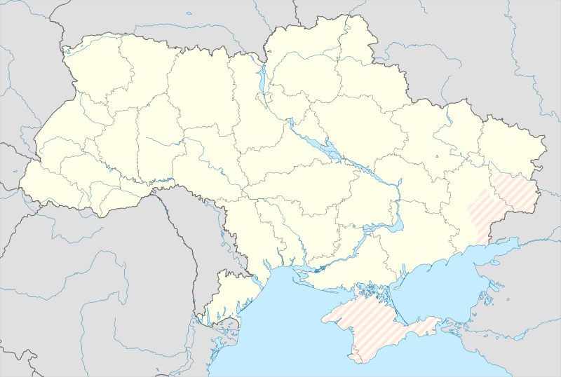
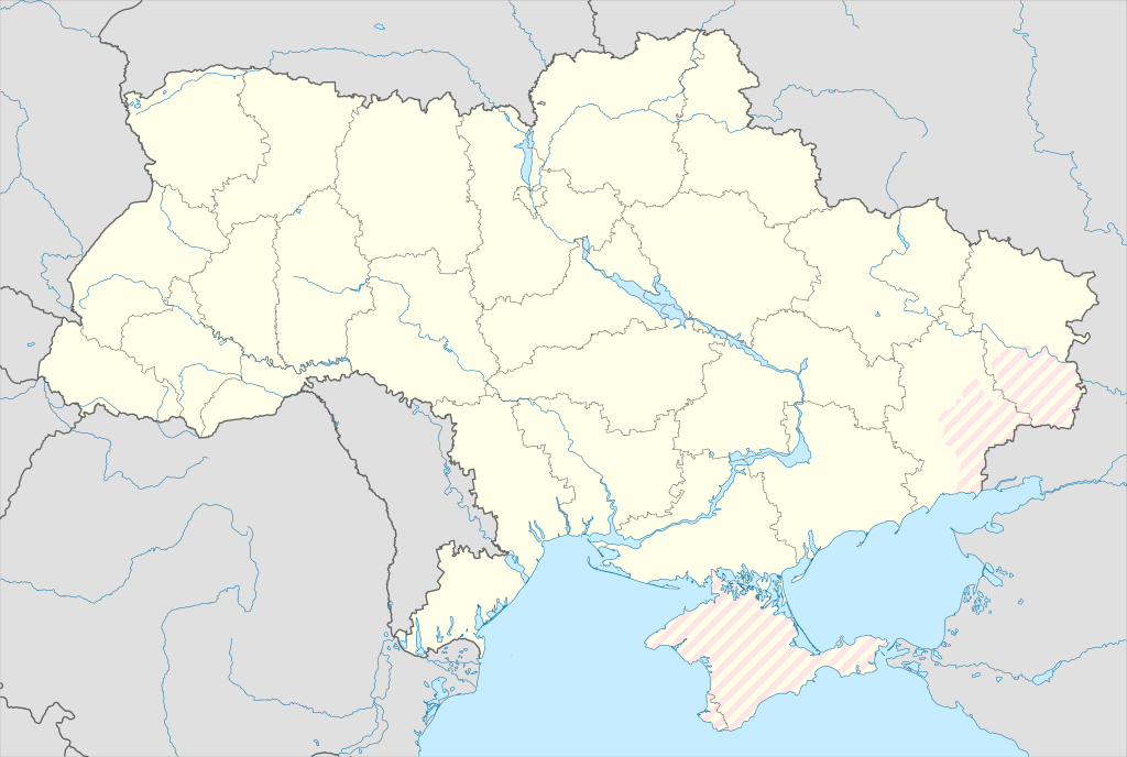
English: Location map of Ukraine under russian occupation.
Українська: Карта України з зонами російської окупації. |
| Date | |
| Source |
Own work using: Ukraine adm location map improved.svg, according to
|
| Author | Yakiv Gluck |
| Other versions |
|
| SVG development | This locator map was created with Adobe Illustrator. |


Licensing
I, the copyright holder of this work, hereby publish it under the following license:
This file is licensed under the Creative Commons Attribution-Share Alike 4.0 International license.
- You are free:
- to share – to copy, distribute and transmit the work
- to remix – to adapt the work
- Under the following conditions:
- attribution – You must give appropriate credit, provide a link to the license, and indicate if changes were made. You may do so in any reasonable manner, but not in any way that suggests the licensor endorses you or your use.
- share alike – If you remix, transform, or build upon the material, you must distribute your contributions under the same or compatible license as the original.
File history
Click on a date/time to view the file as it appeared at that time.
| Date/Time | Thumbnail | Dimensions | User | Comment | |
|---|---|---|---|---|---|
| current | 15:45, 9 August 2023 | | 3,780 × 2,540 (1.36 MB) | Dƶoxar | Until the war ends it has no sense to maintain another map with actual frontline |
| 09:32, 25 July 2023 |  | 3,780 × 2,540 (1.64 MB) | ASDFPM | Reverted to version as of 17:17, 3 October 2022 (UTC) | |
| 02:45, 12 November 2022 |  | 3,780 × 2,540 (1.36 MB) | Qexypnos | Reverted to version as of 17:02, 3 March 2018 (UTC) | |
| 17:17, 3 October 2022 |  | 3,780 × 2,540 (1.64 MB) | Janitoalevic | Update | |
| 17:02, 3 March 2018 |  | 3,780 × 2,540 (1.36 MB) | Yakiv Gluck | improved using new adm loc map | |
| 01:08, 27 January 2018 |  | 1,546 × 1,038 (457 KB) | Yakiv Gluck | {{Information |Description ={{en|Location map of Ukraine under russian occupation.}} {{uk|Карта України з зонами російської окупації.}} |Source =own work, using [[:F... |
File usage
The following pages on the English Wikipedia use this file (pages on other projects are not listed):
Global file usage
The following other wikis use this file:
- Usage on an.wikipedia.org
- Usage on de.wikipedia.org
- Usage on es.wikipedia.org
- Odesa
- Chernóbil
- Kiev
- Hálych
- Nicolaiev
- Bar (Ucrania)
- Eurocopa 2012
- Leópolis
- Jartsyzsk
- Cherkasy
- Poltava
- Mariúpol
- Prípiat
- Donetsk
- Járkov
- Juliaipole
- Ozeryany (Borshchiv)
- Dnipró
- Lugansk
- Jersón
- Sumy
- Krivói Rog
- Ivano-Frankivsk
- Kálush
- Lubní
- Dvirkivshchyna
- Aeropuerto Internacional de Borýspil
- Chornomorsk
- Chernígov
- Bila Tserkva
- Vínnitsa
- Yavoriv
- Lutsk
- Zaporiyia
View more global usage of this file.