
File:Ukbara map.png
No higher resolution available.
Ukbara_map.png (330 × 355 pixels, file size: 27 KB, MIME type: image/png)
| This is a file from the Wikimedia Commons. Information from its description page there is shown below. Commons is a freely licensed media file repository. You can help. |
Summary
| Description | |
| Source | CIA World Fact Book |
| Author | CIA |
Licensing
This image is in the public domain because it contains materials that originally came from the United States Central Intelligence Agency's World Factbook.
|
 |
Original upload log
The original description page was here. All following user names refer to en.wikipedia.
| Date/Time | Dimensions | User | Comment |
|---|---|---|---|
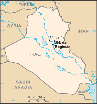
| 2005-01-26 21:00 | 330×355× (27715 bytes) | Mustafaa | Map showing location of [[Ukbara]], based on [[Iraq_map.jpg]] |
File history
Click on a date/time to view the file as it appeared at that time.
| Date/Time | Thumbnail | Dimensions | User | Comment | |
|---|---|---|---|---|---|
| current | 16:48, 11 May 2016 | | 330 × 355 (27 KB) | BD2412 | Transferred from en.wikipedia |
File usage
The following pages on the English Wikipedia use this file (pages on other projects are not listed):
Global file usage
The following other wikis use this file:
- Usage on sh.wikipedia.org