
File:Ug-map.PNG
No higher resolution available.
Ug-map.PNG (330 × 354 pixels, file size: 21 KB, MIME type: image/png)
| This is a file from the Wikimedia Commons. Information from its description page there is shown below. Commons is a freely licensed media file repository. You can help. |
Summary
| Description | |
| Date | |
| Source | Central Intelligence Agency World Factbook |
| Author | Central Intelligence Agency |
Licensing
This image is in the public domain because it contains materials that originally came from the United States Central Intelligence Agency's World Factbook.
|
 |
Original upload log
Transferred from en.wikipedia to Commons using FtCG.
The original description page was here. All following user names refer to en.wikipedia.
| Date/Time | Dimensions | User | Comment |
|---|---|---|---|
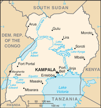
| 22:11, 12 July 2011 | 330 × 354 (21,423 bytes) | w:en:Marfinan (talk | contribs) | (== {{int:filedesc}} == {{Information|Description={{en|[[w:Central Intelligence Agency|CIA]] World Factbook map of the country of [[w:Uganda|Uganda]].}} |Source=https://www.cia.gov/library/publications/the-world-factbook/geos/ug.html |Date=2011-07-12 |Auth) |
File history
Click on a date/time to view the file as it appeared at that time.
| Date/Time | Thumbnail | Dimensions | User | Comment | |
|---|---|---|---|---|---|
| current | 14:23, 12 January 2012 | | 330 × 354 (21 KB) | ARTEST4ECHO | Transferred from en.wikipedia: see original upload log above |
File usage
No pages on the English Wikipedia use this file (pages on other projects are not listed).
Global file usage
The following other wikis use this file:
- Usage on ar.wikipedia.org
- Usage on fa.wikipedia.org