
File:USA Nevada location map.svg

Size of this PNG preview of this SVG file: 408 × 600 pixels. Other resolutions: 163 × 240 pixels | 326 × 480 pixels | 522 × 768 pixels | 696 × 1,024 pixels | 1,393 × 2,048 pixels | 882 × 1,297 pixels.
Original file (SVG file, nominally 882 × 1,297 pixels, file size: 76 KB)
| This is a file from the Wikimedia Commons. Information from its description page there is shown below. Commons is a freely licensed media file repository. You can help. |
Summary
| Description |
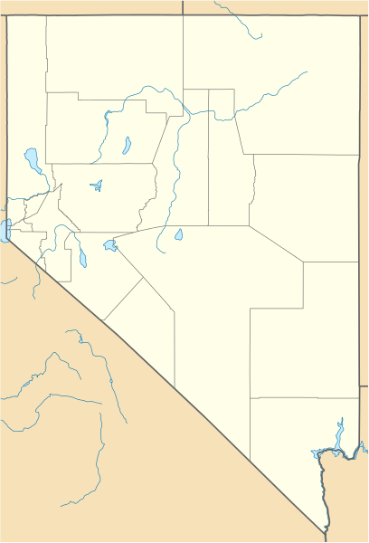
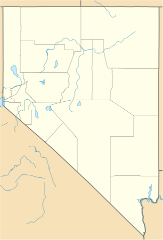
Quadratische Plattkarte, N-S-Streckung 125 %. Geographische Begrenzung der Karte:
Equirectangular projection, N/S stretching 125 %. Geographic limits of the map:
|
| Date | 05-06-2009 |
| Source |
own work, using
|
| Author | NordNordWest |
| Other versions |
Derivative works of this file: |


|
This map has been made or improved in the German Kartenwerkstatt (Map Lab). You can propose maps to improve as well.
|
Licensing
I, the copyright holder of this work, hereby publish it under the following licenses:

|
Permission is granted to copy, distribute and/or modify this document under the terms of the GNU Free Documentation License, Version 1.2 or any later version published by the Free Software Foundation; with no Invariant Sections, no Front-Cover Texts, and no Back-Cover Texts. A copy of the license is included in the section entitled GNU Free Documentation License. |
This file is licensed under the Creative Commons Attribution 3.0 Unported license.
- You are free:
- to share – to copy, distribute and transmit the work
- to remix – to adapt the work
- Under the following conditions:
- attribution – You must give appropriate credit, provide a link to the license, and indicate if changes were made. You may do so in any reasonable manner, but not in any way that suggests the licensor endorses you or your use.
You may select the license of your choice.
File history
Click on a date/time to view the file as it appeared at that time.
| Date/Time | Thumbnail | Dimensions | User | Comment | |
|---|---|---|---|---|---|
| current | 09:33, 5 June 2014 | | 882 × 1,297 (76 KB) | NordNordWest | c |
| 20:03, 5 June 2009 |  | 882 × 1,297 (121 KB) | NordNordWest | {{Information |Description= {{de|Positionskarte von Nevada, USA}} Quadratische Plattkarte, N-S-Streckung 125 %. Geographische Begrenzung der Karte: * N: 42.2° N * S: 34.9° N * W: 120.1° W * O: 113.9° W {{en|Location map of [ |
File usage
More than 100 pages use this file. The following list shows the first 100 pages that use this file only. A full list is available.
- Alamo, Nevada
- Amargosa Valley, Nevada
- Ash Springs, Nevada
- Austin, Nevada
- Bellagio (resort)
- Beowawe, Nevada
- Boardwalk Hotel and Casino
- Boulder City Hospital
- Bourbon Street Hotel and Casino
- Caliente, Nevada
- California Hotel and Casino
- Circus Circus Las Vegas
- Creech Air Force Base
- Derby Dam
- Downtown Las Vegas
- Duckwater, Nevada
- Dunes (hotel and casino)
- El Rancho Vegas
- Empire, Nevada
- Eureka, Nevada
- Excalibur Hotel and Casino
- Flamingo Las Vegas
- Fremont Hotel and Casino
- Gee Jon
- Genoa, Nevada
- Gerlach, Nevada
- Golden Gate Hotel and Casino
- Golden Nugget Las Vegas
- Goldfield, Nevada
- Guardian Angel Cathedral
- Hacienda (resort)
- Hamilton, Nevada
- Hard Rock Hotel and Casino (Las Vegas)
- Harrah's Las Vegas
- Hoover Dam
- Horseshoe Las Vegas
- Incline Village, Nevada
- Jackpot, Nevada
- Jarbidge, Nevada
- Jean, Nevada
- Lamoille, Nevada
- Las Vegas Nevada Temple
- Lida, Nevada
- List of Nevada state parks
- Logandale, Nevada
- Lovelock, Nevada
- Luxor Las Vegas
- MGM Grand Las Vegas
- Main Street Station Hotel and Casino and Brewery
- Mandalay Bay
- McDermitt, Nevada and Oregon
- Mercury, Nevada
- Mesquite, Nevada
- Mina, Nevada
- Mountain Springs, Nevada
- Nevada Northern Railway Museum
- New Frontier Hotel and Casino
- New Washoe City, Nevada
- New York-New York Hotel and Casino
- Overton, Nevada
- Palisade, Nevada
- Panaca, Nevada
- Paradise Valley, Nevada
- Paris Las Vegas
- Park MGM
- Pioche, Nevada
- Planet Hollywood Las Vegas
- Rachel, Nevada
- Ragtown, Nevada
- Rhyolite, Nevada
- Riviera (hotel and casino)
- Sahara Las Vegas
- Saint Thomas Aquinas Cathedral
- Sands Hotel and Casino
- Sedan (nuclear test)
- Showboat Hotel and Casino
- Stardust Resort and Casino
- Steve Fossett
- Summerlin, Nevada
- Summerlin South, Nevada
- Sun Valley, Nevada
- Sunrise Manor, Nevada
- The Linq
- The Mint Las Vegas
- The Mirage
- The Palazzo
- The Venetian Las Vegas
- Tonopah, Nevada
- Treasure Island Hotel and Casino
- Tropicana Las Vegas
- University Medical Center of Southern Nevada
- University of Nevada, Reno
- Valley Hospital Medical Center
- Vegas World
- Virginia City, Nevada
- Warm Springs, Nevada
- Welcome to Fabulous Las Vegas sign
- Wendy's 3-Tour Challenge
- West Wendover, Nevada
- Winnemucca, Nevada
View more links to this file.
Global file usage
The following other wikis use this file:
- Usage on an.wikipedia.org
- Usage on ar.wikipedia.org
- Usage on ast.wikipedia.org
- Usage on azb.wikipedia.org
- درای ولی، نوادا
- قراس ولی، نوادا
- میجرز پلیس، نوادا
- ماوند هاوس، نوادا
- هلک، نوادا
- آرتور، نوادا
- ماونتن سیتی، نوادا
- نورت فورک، نوادا
- اورتون، نوادا
- جک کریک، نوادا
- پلیسید، نوادا
- کونتاکت، نوادا
- وید هایتس، نوادا
- پتسویل، نوادا
- لوقندیل، نوادا
- میداس، نوادا
- کوری، نوادا
- وندربیلت، نوادا
- مرکوری، نوادا
- ریورساید، نوادا
- دیث، نوادا
- پونی اسپرینقز، نوادا
- سن هسینتو، نوادا
- کارپ، نوادا
- استون هاوس، نوادا
- کارورز، نوادا
- بیووا، نوادا
- اسمیت، نوادا
- فورت مکدرمیت، نوادا
- لونینق، نوادا
- ریندن، نوادا
- نیو واشو سیتی، نوادا
- بارکلی، نوادا
- نورت بتل ماونتین، نوادا
- قلندیل، نوادا
- کرستلاین، نوادا
- میسون، نوادا
- میدلقیت، نوادا
- فرنچمن، نوادا
- لی، نوادا
- لوقن کریک، نوادا
- کارتر اسپرینقز، نوادا
- روهنسترات، نوادا
- تاپاز لیک، نوادا
View more global usage of this file.