
File:USA 09669 Taos Pueblo Luca Galuzzi 2007.jpg
Original file (2,000 × 1,333 pixels, file size: 2.37 MB, MIME type: image/jpeg)
| This is a file from the Wikimedia Commons. Information from its description page there is shown below. Commons is a freely licensed media file repository. You can help. |
|
This is an image of a place or building that is listed on the National Register of Historic Places in the United States of America. Its reference number is 66000496. |
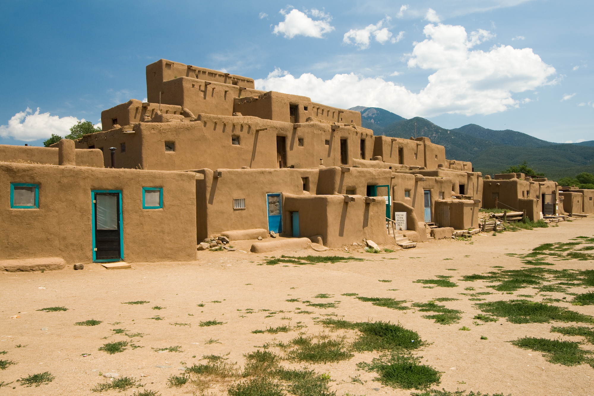
| Description | Taos Pueblo multi-storied residential complex of reddish-brown adobe. It was probably built between 1000 and 1450 A.D. Located about 1 mile (1.6 km) north of the modern city of Taos, New Mexico, USA. | ||
| Date | |||
| Source | Photo taken by (Luca Galuzzi) * http://www.galuzzi.it | ||
| Author | Luca Galuzzi (Lucag) | ||
| Permission (Reusing this file) |
I, Luca Galuzzi, the copyright holder of this work, hereby publishes it under the following license: This file is licensed under the Creative Commons Attribution-Share Alike 2.5 Generic license. Attribution: I, Luca Galuzzi
|

| Object location | | View this and other nearby images on: OpenStreetMap |
|---|
File history
Click on a date/time to view the file as it appeared at that time.
| Date/Time | Thumbnail | Dimensions | User | Comment | |
|---|---|---|---|---|---|
| current | 21:05, 5 September 2007 | | 2,000 × 1,333 (2.37 MB) | Lucag | {{Information |Description=Taos Pueblo multi-storied residential complex of reddish-brown adobe. It was probably built between 1000 and 1450 A.D. Located about 1 mile (1.6 km) north of the modern city of Taos, New Mexico, USA. |Source=Photo taken by ([[Us |
File usage
- Ancestral Puebloans
- Archaic–Early Basketmaker Era
- Basketmaker III Era
- Basketmaker culture
- Chamuscado and Rodríguez Expedition
- Colorado Western Slope
- Early Basketmaker II Era
- Late Basketmaker II Era
- List of Ancestral Puebloan dwellings in Colorado
- List of Ancestral Puebloan dwellings in New Mexico
- List of National Historic Landmarks in New Mexico
- List of World Heritage Sites in North America
- Mountain states
- National Register of Historic Places listings in Taos County, New Mexico
- Prehistory of Colorado
- Pueblo III Period
- Pueblo II Period
- Pueblo IV Period
- Pueblo I Period
- Pueblo Revolt
- Pueblo V Period
- Template:Ancestral Puebloan Periods
Global file usage
The following other wikis use this file:
- Usage on af.wikipedia.org
- Usage on ast.wikipedia.org
- Usage on bat-smg.wikipedia.org
- Usage on be.wikipedia.org
- Usage on bn.wikipedia.org
- Usage on ca.wikipedia.org
- Usage on de.wikipedia.org
- Usage on de.wikibooks.org
- Usage on de.wikivoyage.org
- Usage on en.wikivoyage.org
- Usage on es.wikipedia.org
- Usage on fi.wikipedia.org
- Usage on fr.wikipedia.org
- Usage on he.wikipedia.org
- Usage on hr.wikipedia.org
- Usage on hu.wikipedia.org
View more global usage of this file.