
File:USACE Great Salt Plains Dam.jpg
Size of this preview: 800 × 528 pixels. Other resolutions: 320 × 211 pixels | 640 × 422 pixels | 1,024 × 676 pixels | 1,500 × 990 pixels.
Original file (1,500 × 990 pixels, file size: 206 KB, MIME type: image/jpeg)
| This is a file from the Wikimedia Commons. Information from its description page there is shown below. Commons is a freely licensed media file repository. You can help. |
| Description |
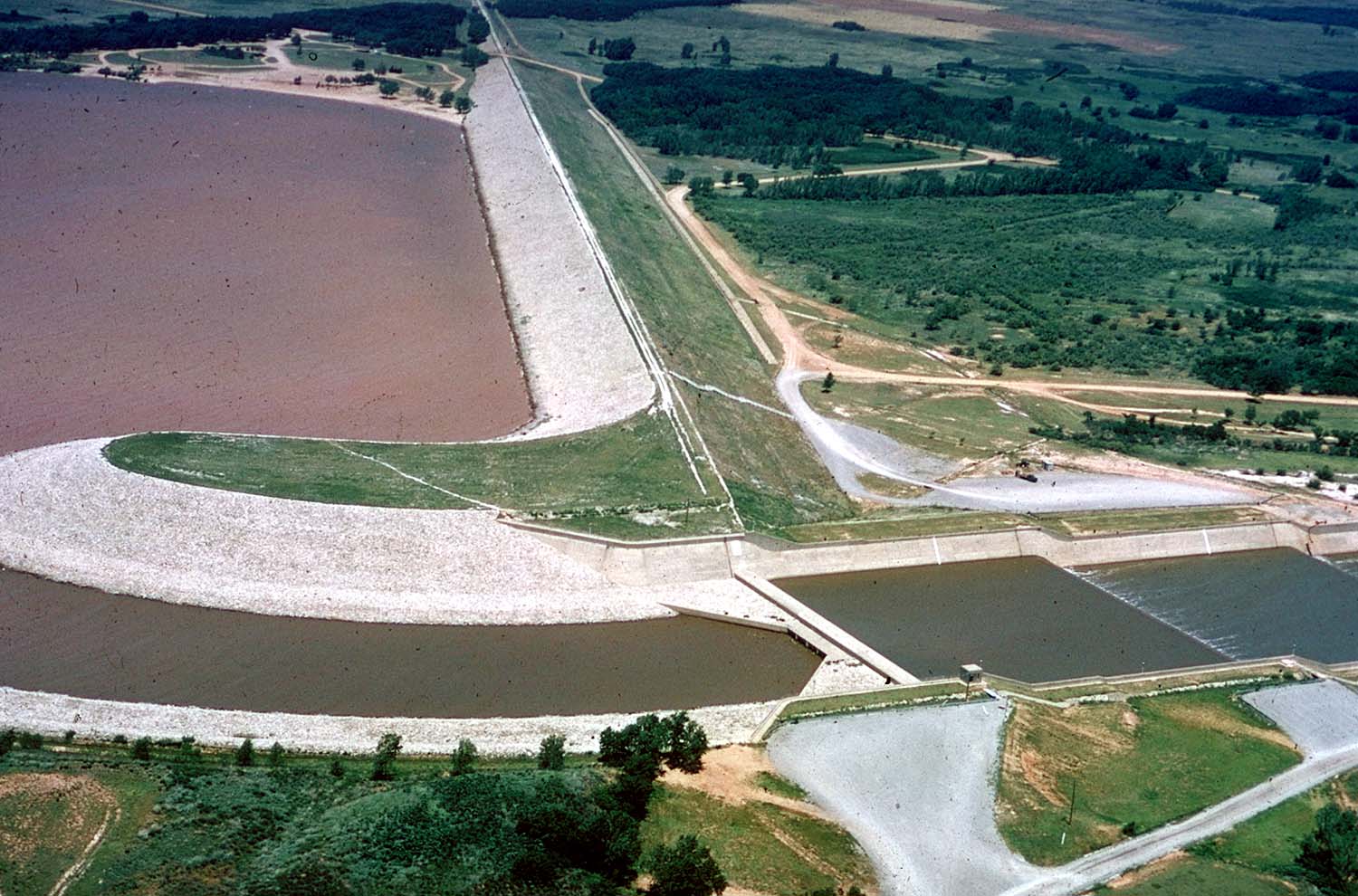
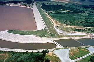
English: Aerial view of Great Salt Plains Lake Dam on the Salt Fork Arkansas River in Alfalfa County, Oklahoma, USA. The dam was constructed by the U.S. Army Corps of Engineers for flood control and water storage. The Great Salt Plains State Park surrounds the dam. View is to the northwest.
Coordinates: 36°44′54.15″N 98°8′20.64″W / 36.748375°N 98.1390667°W |
|||
| Location | Alfalfa County, Oklahoma, USA | |||
| Date | ||||
| Source |
U.S. Army Corps of Engineers Digital Visual Library Image page Image description page Digital Visual Library home page |
|||
| Author | Cheryl Payton, U.S. Army Corps of Engineers | |||
| Permission (Reusing this file) |
|
File history
Click on a date/time to view the file as it appeared at that time.
| Date/Time | Thumbnail | Dimensions | User | Comment | |
|---|---|---|---|---|---|
| current | 16:35, 6 May 2007 | | 1,500 × 990 (206 KB) | DanMS | {{Information | Description = {{en|Aerial view of Great Salt Plains Lake Dam on the Salt Fork Arkansas River in Alfalfa County, Oklahoma, USA. The dam was constructed by the U.S. Army Corps of Engineers for flood control and water storage. The Great Sa |
File usage
The following pages on the English Wikipedia use this file (pages on other projects are not listed):
Global file usage
The following other wikis use this file:
- Usage on es.wikipedia.org
- Usage on ja.wikipedia.org
- Usage on www.wikidata.org