
File:USACE Claiborne Lock and Dam.jpg

Size of this preview: 800 × 523 pixels. Other resolutions: 320 × 209 pixels | 640 × 419 pixels | 1,024 × 670 pixels | 1,280 × 837 pixels | 1,685 × 1,102 pixels.
Original file (1,685 × 1,102 pixels, file size: 428 KB, MIME type: image/jpeg)
| This is a file from the Wikimedia Commons. Information from its description page there is shown below. Commons is a freely licensed media file repository. You can help. |
| Description |
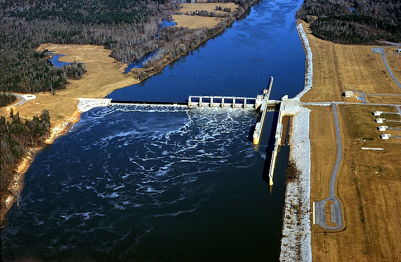
English: Aerial view of Claiborne Lock and Dam on the Alabama River in Monroe County, Alabama, USA. The dam is located approximately 5 miles (8 km) upriver from Claiborne, Alabama. The U.S. Army Corps of Engineers maintains the lock and dam for barge navigation on the river. View is upriver to the north.
Coordinates: 31°36′53.92″N 87°33′2.8″W / 31.6149778°N 87.550778°W |
|||
| Location | Monroe County, Alabama, USA | |||
| Date | ||||
| Source |
U.S. Army Corps of Engineers Digital Visual Library Image page Image description page Digital Visual Library home page |
|||
| Author | Adrien Lamarre, U.S. Army Corps of Engineers | |||
| Permission (Reusing this file) |
|
File history
Click on a date/time to view the file as it appeared at that time.
| Date/Time | Thumbnail | Dimensions | User | Comment | |
|---|---|---|---|---|---|
| current | 20:19, 28 April 2007 | | 1,685 × 1,102 (428 KB) | DanMS | {{Information | Description = {{en|Aerial view of Claiborne Lock and Dam on the Alabama River in Monroe County, Alabama, USA. The dam is located approximately 5 miles (8 km) upriver from Claiborne, Alabama. The U.S. Army Corps of Engineers maintains th |
File usage
The following pages on the English Wikipedia use this file (pages on other projects are not listed):
Global file usage
The following other wikis use this file:
- Usage on ar.wikipedia.org
- Usage on de.wikipedia.org
- Usage on fr.wikipedia.org
- Usage on fy.wikipedia.org
- Usage on ja.wikipedia.org
- Usage on jv.wikipedia.org
- Usage on xmf.wikipedia.org