
File:US-Canada-Border-Provinces.svg

Size of this PNG preview of this SVG file: 429 × 420 pixels. Other resolutions: 245 × 240 pixels | 490 × 480 pixels | 784 × 768 pixels | 1,046 × 1,024 pixels | 2,092 × 2,048 pixels.
Original file (SVG file, nominally 429 × 420 pixels, file size: 380 KB)
| This is a file from the Wikimedia Commons. Information from its description page there is shown below. Commons is a freely licensed media file repository. You can help. |
Summary
| Description |
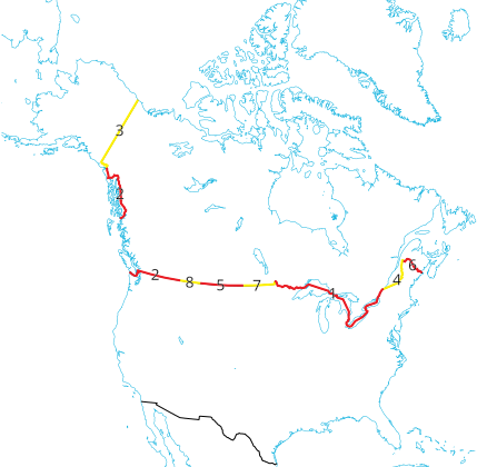
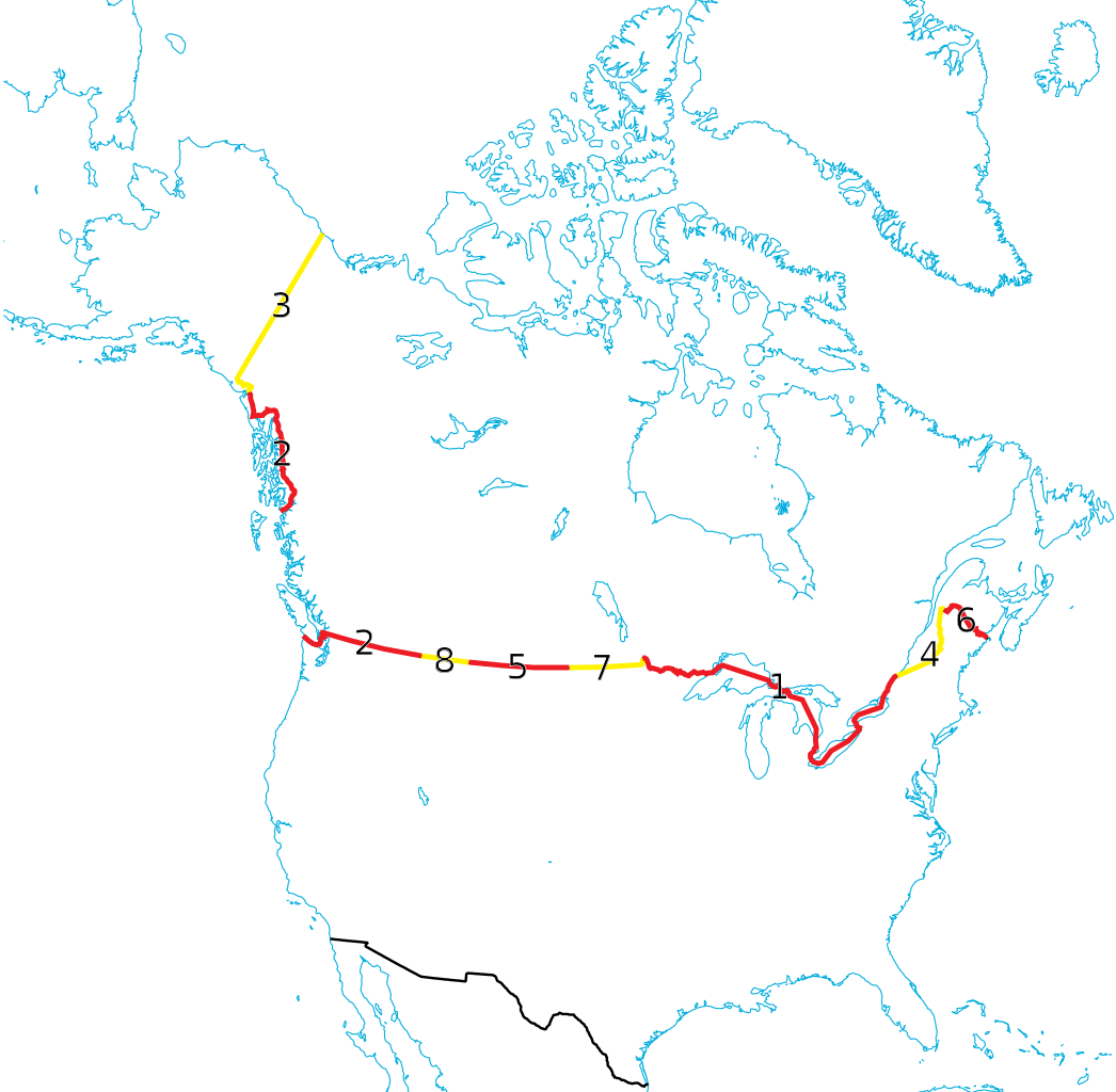
English: Map showing border lengths by province (Canada-United States border). |
| Date | 29 July 2008 (original upload date) |
| Source | (Original text: IPhizzy (talk). created this work entirely by myself. |
| Author | Phizzy at English Wikipedia |
Licensing
Phizzy at the English Wikipedia, the copyright holder of this work, hereby publishes it under the following license:

|
Permission is granted to copy, distribute and/or modify this document under the terms of the GNU Free Documentation License, Version 1.2 or any later version published by the Free Software Foundation; with no Invariant Sections, no Front-Cover Texts, and no Back-Cover Texts. A copy of the license is included in the section entitled GNU Free Documentation License. |
| This file is licensed under the Creative Commons Attribution-Share Alike 3.0 Unported license. | ||
| Attribution: Phizzy at the English Wikipedia | ||
| ||
| This licensing tag was added to this file as part of the GFDL licensing update. |
Original upload log
Transferred from en.wikipedia to Commons by Sfan00_IMG using CommonsHelper.
The original description page was here. All following user names refer to en.wikipedia.
- 2008-07-29 01:35 Phizzy 429×420× (389452 bytes)
- 2008-07-28 23:43 Phizzy 428×419× (389279 bytes) == Information == {{Information |Description=Map showing border lengths by state (Canada-United States border). |Source=I created this work entirely by myself. |Date= |Author=[[User:Phizzy|Phizzy]] ([[User talk:Phizzy|talk]]) |other_versions= }} == Licen
File history
Click on a date/time to view the file as it appeared at that time.
| Date/Time | Thumbnail | Dimensions | User | Comment | |
|---|---|---|---|---|---|
| current | 19:08, 14 January 2010 | | 429 × 420 (380 KB) | File Upload Bot (Magnus Manske) | {{BotMoveToCommons|en.wikipedia|year={{subst:CURRENTYEAR}}|month={{subst:CURRENTMONTHNAME}}|day={{subst:CURRENTDAY}}}} {{Information |Description={{en|Map showing border lengths by province (Canada-United States border).}} |Source=Transferred from [http: |
File usage
The following pages on the English Wikipedia use this file (pages on other projects are not listed):
Global file usage
The following other wikis use this file:
- Usage on ar.wikipedia.org
- Usage on ca.wikipedia.org
- Usage on de.wikipedia.org
- Usage on es.wikipedia.org
- Usage on eu.wikipedia.org
- Usage on fa.wikipedia.org
- Usage on fi.wikipedia.org
- Usage on he.wikipedia.org
- Usage on id.wikipedia.org
- Usage on it.wikipedia.org
- Usage on ja.wikipedia.org
- Usage on ko.wikipedia.org
- Usage on ms.wikipedia.org
- Usage on nl.wikipedia.org
- Usage on pl.wikipedia.org
- Usage on ru.wikipedia.org
- Usage on zh.wikipedia.org