
File:TyreMap1764 JacquesNicolasBellin LePetitAtlasMaritime III-17-b.jpg
Size of this preview: 481 × 600 pixels. Other resolutions: 192 × 240 pixels | 385 × 480 pixels | 616 × 768 pixels | 821 × 1,024 pixels | 1,642 × 2,048 pixels | 2,765 × 3,448 pixels.
Original file (2,765 × 3,448 pixels, file size: 5.01 MB, MIME type: image/jpeg)
| This is a file from the Wikimedia Commons. Information from its description page there is shown below. Commons is a freely licensed media file repository. You can help. |
Summary
| Description |
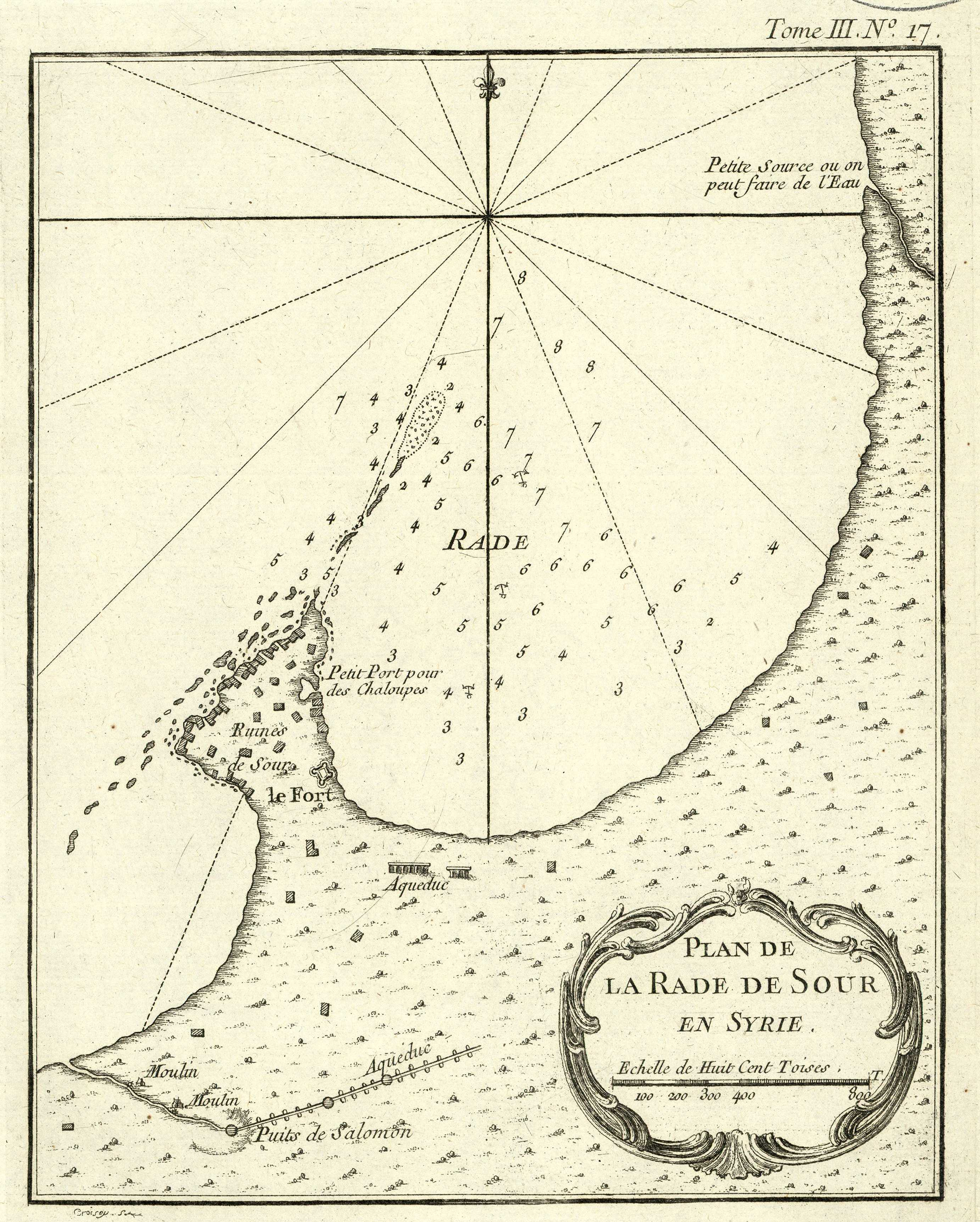
English: Map of the peninsula of Tyre/Sour in what is now Southern Lebanon, published in 1764 in Paris, drawn by French hydrographer and geographer Jacques Nicolas BELLIN |
| Date | |
| Source | "Le Petit Atlas maritime recueil de cartes et plans des quatre parties du Monde", Paris 1764 |
| Author | Jacques Nicolas BELLIN (1703 – 21 March 1772) |
Licensing
|
This work is in the public domain in its country of origin and other countries and areas where the copyright term is the author's life plus 70 years or fewer. This work is in the public domain in the United States because it was published (or registered with the U.S. Copyright Office) before January 1, 1929. | |
| This file has been identified as being free of known restrictions under copyright law, including all related and neighboring rights. | |
File history
Click on a date/time to view the file as it appeared at that time.
| Date/Time | Thumbnail | Dimensions | User | Comment | |
|---|---|---|---|---|---|
| current | 12:59, 26 February 2020 | | 2,765 × 3,448 (5.01 MB) | RomanDeckert | User created page with UploadWizard |
File usage
The following pages on the English Wikipedia use this file (pages on other projects are not listed):