
File:Txu-oclc-224300691-se19-6.jpg

Size of this preview: 788 × 600 pixels. Other resolutions: 316 × 240 pixels | 631 × 480 pixels | 1,010 × 768 pixels | 1,280 × 974 pixels | 2,560 × 1,948 pixels | 5,164 × 3,929 pixels.
Original file (5,164 × 3,929 pixels, file size: 10.27 MB, MIME type: image/jpeg)
| This is a file from the Wikimedia Commons. Information from its description page there is shown below. Commons is a freely licensed media file repository. You can help. |
Summary
| Description |
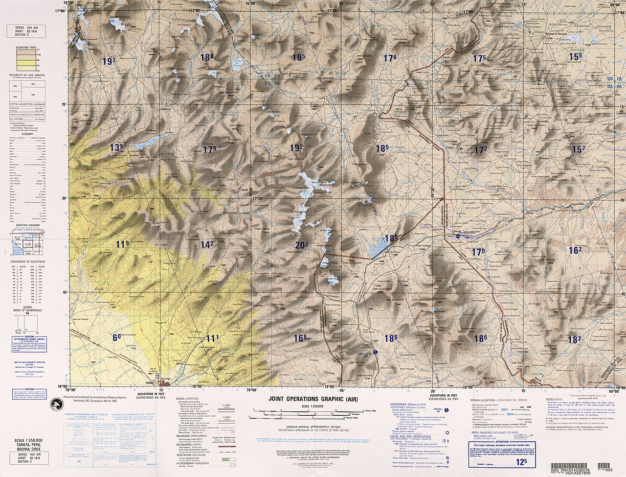
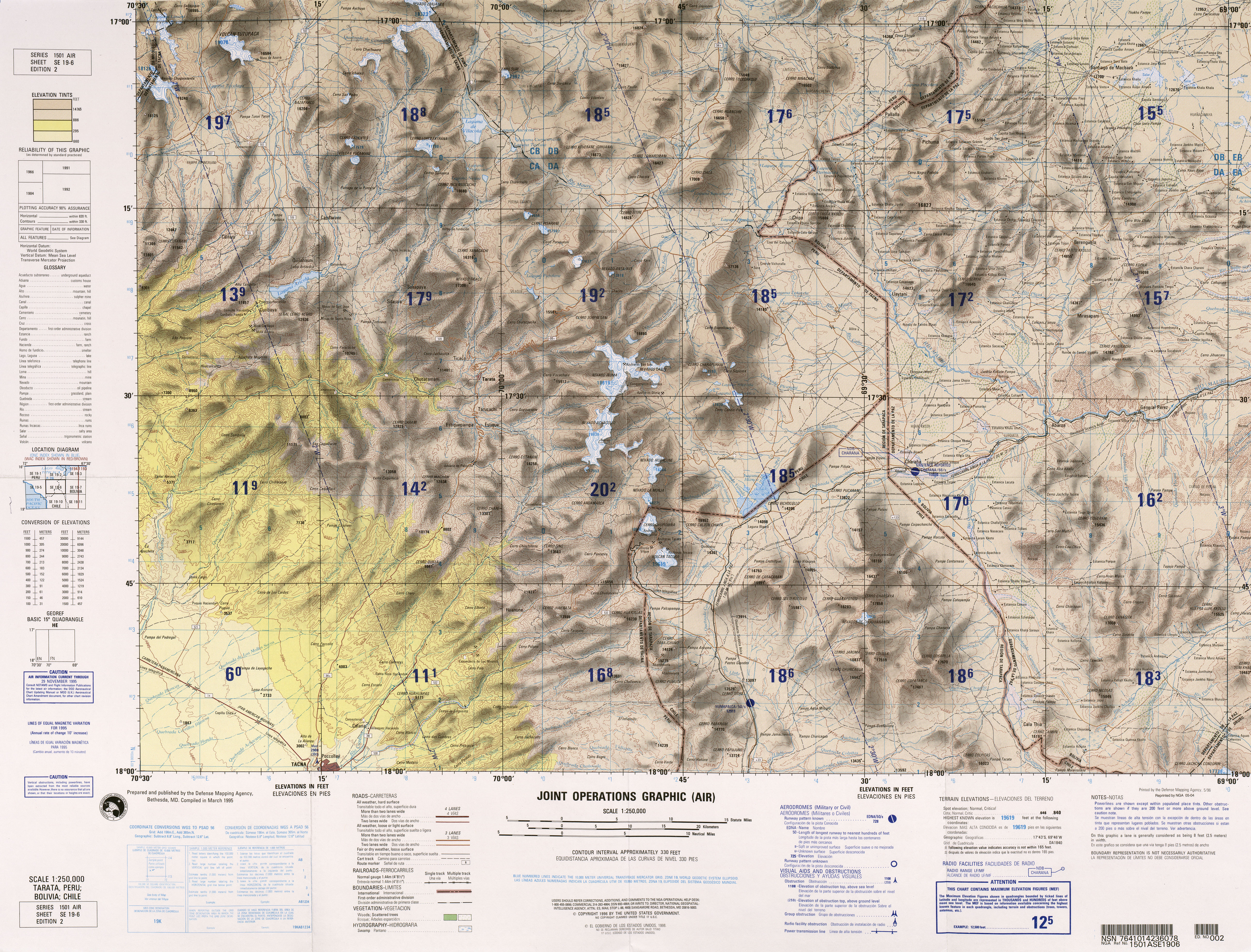
English: frontera Chile-Peru-Bolivia, Tacna |
|||
| Date | ||||
| Source | http://www.lib.utexas.edu/maps/jog/latin_america/txu-oclc-224300691-se19-6.jpg | |||
| Author | This work is in the public domain in the United States because it is a work of the United States Federal Government under the terms of 17 U.S.C. § 105. See Copyright. | |||
| Permission (Reusing this file) |
|
|||
| Other versions | Derivative works of this file: Río-cosapilla.png |

.jpg)
File history
Click on a date/time to view the file as it appeared at that time.
| Date/Time | Thumbnail | Dimensions | User | Comment | |
|---|---|---|---|---|---|
| current | 23:03, 30 December 2011 | | 5,164 × 3,929 (10.27 MB) | Keysanger |
File usage
The following pages on the English Wikipedia use this file (pages on other projects are not listed):
Global file usage
The following other wikis use this file:
- Usage on arz.wikipedia.org
- Usage on ca.wikipedia.org
- Usage on ceb.wikipedia.org
- Usage on de.wikipedia.org
- Usage on es.wikipedia.org
- Usage on ka.wikipedia.org
- Usage on pt.wikipedia.org
- Usage on qu.wikipedia.org
- Usage on www.wikidata.org
- Usage on zh.wikipedia.org