
File:Tuscaloosa tornado damage 27 April 2011.jpg

Size of this preview: 800 × 600 pixels. Other resolutions: 320 × 240 pixels | 640 × 480 pixels | 1,024 × 768 pixels | 1,280 × 960 pixels | 2,048 × 1,536 pixels.
Original file (2,048 × 1,536 pixels, file size: 887 KB, MIME type: image/jpeg)
| This is a file from the Wikimedia Commons. Information from its description page there is shown below. Commons is a freely licensed media file repository. You can help. |
Summary
| Description |
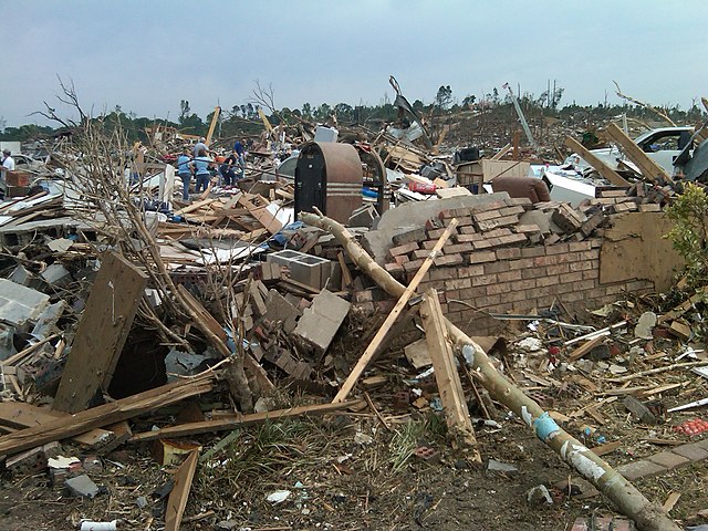
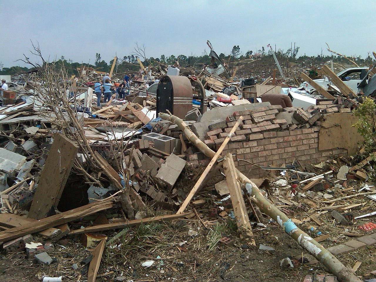
English: EF-4 damage to a residence on the afternoon of April 27, 2011. |
| Date | |
| Source | http://www.srh.noaa.gov/bmx/?n=event_04272011tuscbirm |
| Author | National Weather Service in Birmingham, Alabama |
| Camera location | | View this and other nearby images on: OpenStreetMap |
|---|
Licensing
This image is in the public domain because it contains materials that originally came from the U.S. National Oceanic and Atmospheric Administration, taken or made as part of an employee's official duties.
|
File history
Click on a date/time to view the file as it appeared at that time.
| Date/Time | Thumbnail | Dimensions | User | Comment | |
|---|---|---|---|---|---|
| current | 00:21, 8 December 2013 | | 2,048 × 1,536 (887 KB) | Wxtrackercody | {{subst:Upload marker added by en.wp UW}} {{Information |Description = {{en|EF-4 damage to a residence on the afternoon of April 27, 2011.}} |Source = http://www.srh.noaa.gov/bmx/?n=event_04272011tuscbirm |Date = 8 December 2013 |Author = National Weat... |
File usage
The following pages on the English Wikipedia use this file (pages on other projects are not listed):
Global file usage
The following other wikis use this file:
- Usage on ha.wikipedia.org
- Usage on simple.wikipedia.org