
File:Truck Hauling 36-inch Pipe To Build Keystone XL Pipeline.jpg

Size of this preview: 800 × 206 pixels. Other resolutions: 320 × 82 pixels | 640 × 165 pixels | 2,287 × 589 pixels.
Original file (2,287 × 589 pixels, file size: 352 KB, MIME type: image/jpeg)
| This is a file from the Wikimedia Commons. Information from its description page there is shown below. Commons is a freely licensed media file repository. You can help. |
Summary
| Description |
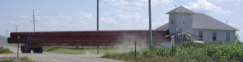
English: Truck hauling 36-Inch Pipe to build Keystone-Cushing Pipeline (Phase 2) southeast of Peabody, Kansas, USA. Location is Timber Rd and 20th St in Marion County. Looking southwest with rural Whitewater Center Church in background. Photo by Steve Meirowsky on July 10, 2010. Note 1: The rear wheels on this truck has independent steering. Note 2: The pipeline is located 0.6 miles west of this corner. |
| Date | |
| Source | Own work from https://www.flickr.com/photos/stevemeirowsky/4856689862/ |
| Author | Steve Meirowsky (Wikipedia) (Flickr) |
| Camera location | | View this and other nearby images on: OpenStreetMap |
|---|
Licensing
I, the copyright holder of this work, hereby publish it under the following license:
This file is licensed under the Creative Commons Attribution-Share Alike 3.0 Unported license.
- You are free:
- to share – to copy, distribute and transmit the work
- to remix – to adapt the work
- Under the following conditions:
- attribution – You must give appropriate credit, provide a link to the license, and indicate if changes were made. You may do so in any reasonable manner, but not in any way that suggests the licensor endorses you or your use.
- share alike – If you remix, transform, or build upon the material, you must distribute your contributions under the same or compatible license as the original.
| This image, originally posted to Flickr, was reviewed on 3 August 2010 by the administrator or reviewer Fr33kman, who confirmed that it was available on Flickr under the stated license on that date. |
File history
Click on a date/time to view the file as it appeared at that time.
| Date/Time | Thumbnail | Dimensions | User | Comment | |
|---|---|---|---|---|---|
| current | 10:55, 3 August 2010 | 2,287 × 589 (352 KB) | Sbmeirow | {{Information |Description=Location is Timber Rd and 20th St in Front of Whitewater Center Church, SE of Peabody, Kansas in Marion County. Photo taken by Steve Meirowsky on July 10, 2010. |Source=[http://www.flickr.com/photos/stevemeirowsky/4856689862/ Tr |
File usage
The following pages on the English Wikipedia use this file (pages on other projects are not listed):
Global file usage
The following other wikis use this file:
- Usage on de.wikipedia.org
- Usage on fr.wikipedia.org
- Usage on nl.wikipedia.org
- Usage on sv.wikipedia.org