
File:Tropical Storm Ida 2009 on November 9 near Gulf Coast.jpg

Size of this preview: 450 × 600 pixels. Other resolutions: 180 × 240 pixels | 360 × 480 pixels | 576 × 768 pixels | 768 × 1,024 pixels | 1,536 × 2,048 pixels | 3,600 × 4,800 pixels.
Original file (3,600 × 4,800 pixels, file size: 1.74 MB, MIME type: image/jpeg)
| This is a file from the Wikimedia Commons. Information from its description page there is shown below. Commons is a freely licensed media file repository. You can help. |
Summary
| Description |
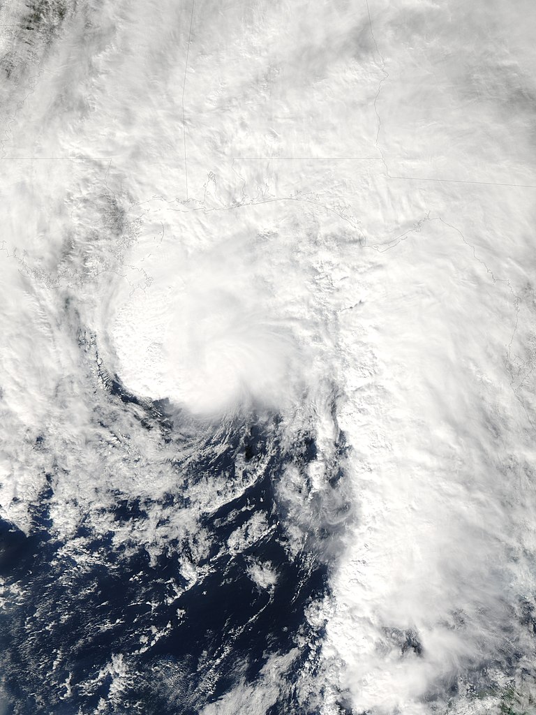
English: Ida maintains a roughly circular shape off the coasts of Louisiana, Mississippi, and Alabama. Immediately to the east, a wall of clouds stretches southward over the Gulf of Mexico west of Florida. Storm clouds also extend far inland over the Gulf states. |
| Date | |
| Source | NASA Earh Observatory |
| Author | Jeff Schmaltz |
Image captured by the Moderate Resolution Imaging Spectroradiometer (MODIS) on NASA’s Aqua satellite.
Licensing
| This file is in the public domain in the United States because it was solely created by NASA. NASA copyright policy states that "NASA material is not protected by copyright unless noted". (See Template:PD-USGov, NASA copyright policy page or JPL Image Use Policy.) | ||
 |
Warnings:
|
| Annotations | This image is annotated: View the annotations at Commons |
File history
Click on a date/time to view the file as it appeared at that time.
| Date/Time | Thumbnail | Dimensions | User | Comment | |
|---|---|---|---|---|---|
| current | 11:26, 11 November 2009 | | 3,600 × 4,800 (1.74 MB) | Originalwana | {{Information |Description={{en|1=Ida maintains a roughly circular shape off the coasts of Louisiana, Mississippi, and Alabama. Immediately to the east, a wall of clouds stretches southward over the Gulf of Mexico west of Florida. Stor |
File usage
The following pages on the English Wikipedia use this file (pages on other projects are not listed):
Global file usage
The following other wikis use this file:
- Usage on es.wikipedia.org
- Usage on pt.wikipedia.org
- Usage on zh.wikipedia.org