
File:Tropical Depression One 2009 GOES.jpg

Size of this preview: 800 × 600 pixels. Other resolutions: 320 × 240 pixels | 640 × 480 pixels | 1,024 × 768 pixels | 1,280 × 960 pixels.
Original file (1,280 × 960 pixels, file size: 1,021 KB, MIME type: image/jpeg)
| This is a file from the Wikimedia Commons. Information from its description page there is shown below. Commons is a freely licensed media file repository. You can help. |
Summary
| Description |
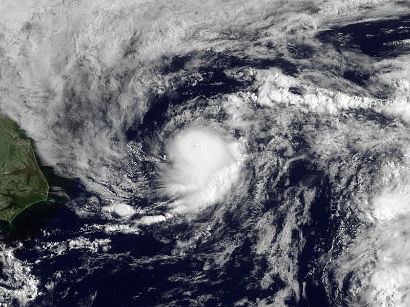
English: Shower activity has increased this morning in association with the area of low pressure located about 225 miles east-northeast of Cape Hatteras North Carolina. The low is currently moving to the northeast at 15 MPH along the relatively warm waters of the gulf stream. This system still has some potential to become a tropical cyclone over the next 12-24 hours but is not expected to threaten any land areas. |
| Date | |
| Source | http://www.nnvl.noaa.gov/MediaDetail.php?MediaID=210&MediaTypeID=1 |
| Author | NOAA; GOES |
| Permission (Reusing this file) |
Public domain |
Licensing
This image is in the public domain because it contains materials that originally came from the U.S. National Oceanic and Atmospheric Administration, taken or made as part of an employee's official duties.
|
File history
Click on a date/time to view the file as it appeared at that time.
| Date/Time | Thumbnail | Dimensions | User | Comment | |
|---|---|---|---|---|---|
| current | 20:27, 18 March 2013 | | 1,280 × 960 (1,021 KB) | Supportstorm | Fix |
| 23:02, 14 May 2010 |  | 1,280 × 960 (1,001 KB) | Supportstorm | Contrast Correction | |
| 20:09, 15 August 2009 |  | 1,280 × 960 (886 KB) | Cyclonebiskit | {{Information |Description={{en|1=Shower activity has increased this morning in association with the area of low pressure located about 225 miles east-northeast of Cape Hatteras North Carolina. The low is currently moving to the northeast at 15 MPH along |
File usage
The following pages on the English Wikipedia use this file (pages on other projects are not listed):
Global file usage
The following other wikis use this file:
- Usage on bg.wikipedia.org
- Usage on de.wikipedia.org
- Usage on es.wikipedia.org
- Usage on eu.wikipedia.org
- Usage on fr.wikipedia.org
- Usage on nl.wikipedia.org
- Usage on pt.wikipedia.org
- Usage on ru.wikipedia.org
- Usage on zh.wikipedia.org