
File:Trier Sankt Matthias BW 1.JPG

Size of this preview: 402 × 599 pixels. Other resolutions: 161 × 240 pixels | 322 × 480 pixels | 515 × 768 pixels | 687 × 1,024 pixels | 2,172 × 3,235 pixels.
Original file (2,172 × 3,235 pixels, file size: 2.48 MB, MIME type: image/jpeg)
| This is a file from the Wikimedia Commons. Information from its description page there is shown below. Commons is a freely licensed media file repository. You can help. |
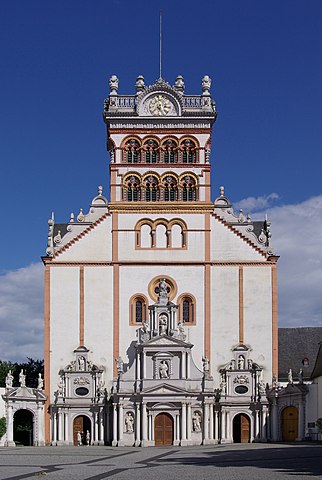
Mathias Kirche
Summary
| Camera location | | View this and other nearby images on: OpenStreetMap |
|---|
| Description |
|
| Date | Taken on 20 July 2008 |
| Source | Own work |
| Author | Berthold Werner |
| Other versions | http://www.bildindex.de/document/obj20112411?part=0&medium=fmc435899 |
Licensing
| I, the copyright holder of this work, release this work into the public domain. This applies worldwide. In some countries this may not be legally possible; if so: I grant anyone the right to use this work for any purpose, without any conditions, unless such conditions are required by law. |
This image has been assessed using the Quality image guidelines and is considered a Quality image.
|

|
This image has been assessed under the valued image criteria and is considered the most valued image on Commons within the scope: St. Matthias' Abbey, Trier. You can see its nomination here. |
File history
Click on a date/time to view the file as it appeared at that time.
| Date/Time | Thumbnail | Dimensions | User | Comment | |
|---|---|---|---|---|---|
| current | 13:48, 12 August 2009 | | 2,172 × 3,235 (2.48 MB) | Berthold Werner | Perspektive noch etwas verbessert |
| 06:24, 21 July 2008 |  | 2,179 × 3,268 (2.17 MB) | Berthold Werner | Perspektive korrigiert | |
| 17:54, 20 July 2008 |  | 2,196 × 3,293 (2.71 MB) | Berthold Werner | {{Information |Description={{de|1=Trier, St. Matthias}} |Source=Eigenes Werk (own work) |Author=Berthold Werner |Date=2008-07-20 |Permission= |other_versions= }} {{ImageUpload|full}} Category:Trier |
File usage
The following pages on the English Wikipedia use this file (pages on other projects are not listed):
Global file usage
The following other wikis use this file:
- Usage on cs.wikipedia.org
- Usage on de.wikipedia.org
- Matthias (Apostel)
- Benediktinerabtei St. Matthias
- Trier-Süd
- Diskussion:Trier/Archiv/1
- Trier
- Portal:Trier/Artikel des Monats
- Mosel-Camino
- Eifel-Camino
- Edmund Renard (der Jüngere)
- Liste der Kirchen im Bistum Trier
- Matthiasstraße (Trier)
- Benutzer:Bernd Hüttemann/Via Coloniensis
- Liste von Sakralbauten in Trier
- Liste der Kulturdenkmäler in Trier-Süd
- Usage on de.wikivoyage.org
- Usage on en.wikivoyage.org
- Usage on es.wikipedia.org
- Usage on fr.wikipedia.org
- Usage on id.wikipedia.org
- Usage on is.wikipedia.org
- Usage on it.wikipedia.org
- Usage on nl.wikipedia.org
- Usage on pl.wikipedia.org
- Usage on www.wikidata.org
- Usage on zh.wikipedia.org