
File:Tranchot uebersicht.svg

Size of this PNG preview of this SVG file: 376 × 599 pixels. Other resolutions: 150 × 240 pixels | 301 × 480 pixels | 482 × 768 pixels | 643 × 1,024 pixels | 1,285 × 2,048 pixels | 590 × 940 pixels.
Original file (SVG file, nominally 590 × 940 pixels, file size: 102 KB)
| This is a file from the Wikimedia Commons. Information from its description page there is shown below. Commons is a freely licensed media file repository. You can help. |
Summary
| Description |
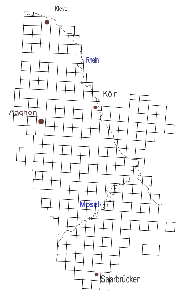
English: Tranchot / von Mueffling: Overview over the Map 1803-1820.
Deutsch: Übersicht über die Blätter der Kartenaufnahme der Rheinlande durch Tranchot und von Müffling 1803 - 1820 |
| Date | 12.11.2008 |
| Source | Own work |
| Author | Sebastian V |
Work in progress, will be improved soon. Please notice me if you do so, so I can work at the best version.
Licensing
| I, the copyright holder of this work, release this work into the public domain. This applies worldwide. In some countries this may not be legally possible; if so: I grant anyone the right to use this work for any purpose, without any conditions, unless such conditions are required by law. |
File history
Click on a date/time to view the file as it appeared at that time.
| Date/Time | Thumbnail | Dimensions | User | Comment | |
|---|---|---|---|---|---|
| current | 00:44, 30 March 2010 | | 590 × 940 (102 KB) | AnonMoos | fixing margins |
| 22:57, 12 November 2008 |  | 744 × 1,052 (103 KB) | Sebastian V | {{Information |Description= |Source= |Date= |Author= |Permission= |other_versions= }} | |
| 22:45, 12 November 2008 |  | 744 × 1,052 (71 KB) | Sebastian V | {{Information |Description={{en|1=Tranchot / von Mueffling: Overview over the Map 1803-1820.}} {{de|1=Übersicht über die Blätter der Kartenaufnahme der Rheinlande durch Tranchot und von Müffling 1803 - 1820}} |Source=Eigenes Werk (own work) |Author=[[ |
File usage
The following pages on the English Wikipedia use this file (pages on other projects are not listed):
Global file usage
The following other wikis use this file:
- Usage on de.wikipedia.org
- Usage on nl.wikipedia.org