
File:Topographic Map of Bulgaria English.png
Size of this preview: 800 × 545 pixels. Other resolutions: 320 × 218 pixels | 640 × 436 pixels | 1,024 × 698 pixels | 1,280 × 873 pixels | 2,200 × 1,500 pixels.
Original file (2,200 × 1,500 pixels, file size: 4.22 MB, MIME type: image/png)
| This is a file from the Wikimedia Commons. Information from its description page there is shown below. Commons is a freely licensed media file repository. You can help. |
Summary
| Description |
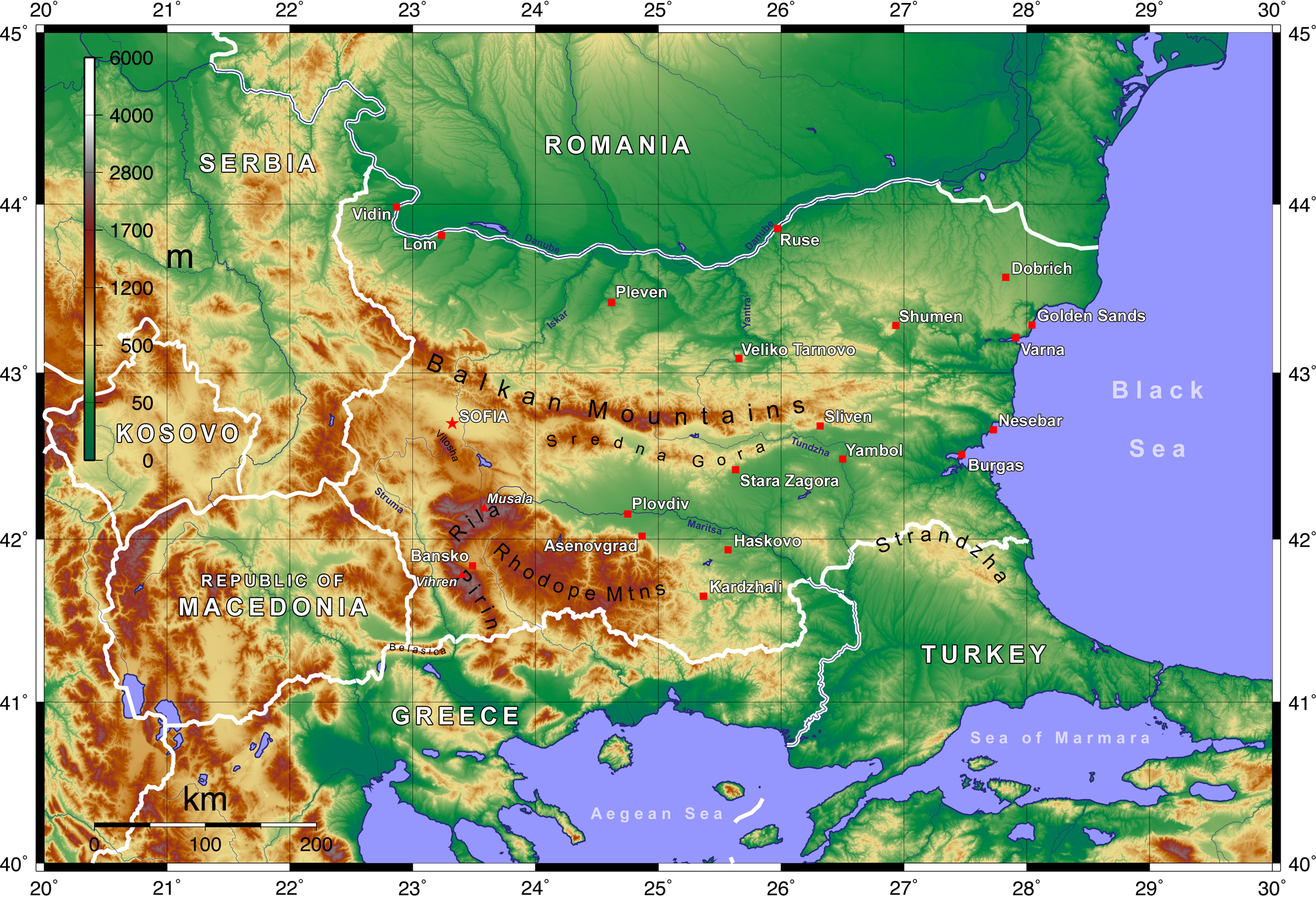
English: Topographic map of Bulgaria with English labels, created with GMT and elevation data from the SRTM
Deutsch: Topographische Karte Bulgariens mit Beschriftung in englischer Sprache; erstellt mit den GMT unter Verwendung der SRTM-3-Höhendaten |
| Date | 02.05.2008 |
| Source | Own work |
| Author | Equestenebrarum |
| Permission (Reusing this file) |
Creative Commons Attribution 3.0 |
| Other versions |
Derivative works of this file: Topographic Map of Bulgaria Francais.png
|


Licensing
I, the copyright holder of this work, hereby publish it under the following license:
This file is licensed under the Creative Commons Attribution 3.0 Unported license.
- You are free:
- to share – to copy, distribute and transmit the work
- to remix – to adapt the work
- Under the following conditions:
- attribution – You must give appropriate credit, provide a link to the license, and indicate if changes were made. You may do so in any reasonable manner, but not in any way that suggests the licensor endorses you or your use.
File history
Click on a date/time to view the file as it appeared at that time.
| Date/Time | Thumbnail | Dimensions | User | Comment | |
|---|---|---|---|---|---|
| current | 20:42, 2 June 2008 | | 2,200 × 1,500 (4.22 MB) | Equestenebrarum | {{Information |Description={{en|1=Topographic map of Bulgaria with English labels, created with GMT and elevation data from the SRTM}} {{de|1=Topographische Karte Bulgariens mit Beschriftung in englischer Sprache; erstellt mit den GMT unter Verwendung der |
File usage
The following pages on the English Wikipedia use this file (pages on other projects are not listed):
Global file usage
The following other wikis use this file:
- Usage on azb.wikipedia.org
- Usage on fr.wikipedia.org
- Usage on ja.wikipedia.org
- Usage on tr.wikipedia.org
- Usage on www.wikidata.org