
File:Thornton Lakes 25929.JPG
Size of this preview: 800 × 600 pixels. Other resolutions: 320 × 240 pixels | 640 × 480 pixels | 1,024 × 768 pixels | 1,280 × 960 pixels | 2,560 × 1,920 pixels.
Original file (2,560 × 1,920 pixels, file size: 1.76 MB, MIME type: image/jpeg)
| This is a file from the Wikimedia Commons. Information from its description page there is shown below. Commons is a freely licensed media file repository. You can help. |
Summary
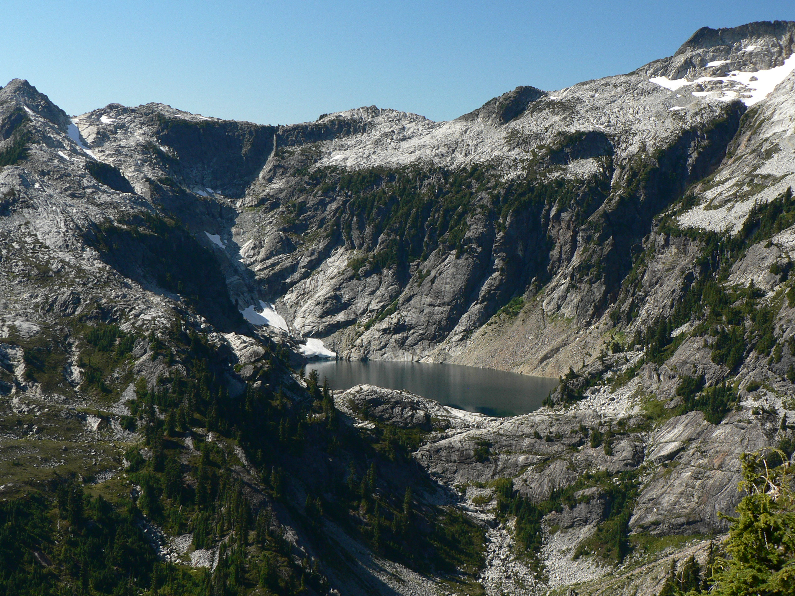
Thornton Lakes
| Description |
English: Thornton Lakes Upper Thornton Lake, 5040 feet, 1536 m
Français : Le lac de Thorton supérieur (Upper Thorton Lake), dans le Parc national des North Cascade, dans le Washington (États-Unis). |
| Date | 14 September 2007, 14:05:48 −07:00 |
| Source | Own work |
| Author | Walter Siegmund |
| Other versions |
|


| Camera location | | View this and other nearby images on: OpenStreetMap |
|---|
- Location Datum: WGS84
- Viewpoint location: Thornton Lakes, Trappers Peak Trail, North Cascades National Park
- Viewpoint elevation: 1759 meter (5771 ft)
- View direction: West
- Camera: Panasonic DMC-FZ5
- Exposure Time: 1/160
- F Number: f/4.0
- Focal Length: 11.0
- Focal Length In 35mm Film: 66
- ISO Speed Rating: 80
©2007 Walter Siegmund
Licensing
I, the copyright holder of this work, hereby publish it under the following licenses:

|
Permission is granted to copy, distribute and/or modify this document under the terms of the GNU Free Documentation License, Version 1.2 or any later version published by the Free Software Foundation; with no Invariant Sections, no Front-Cover Texts, and no Back-Cover Texts. A copy of the license is included in the section entitled GNU Free Documentation License. |
| This file is licensed under the Creative Commons Attribution-Share Alike 3.0 Unported license. | ||
| ||
| This licensing tag was added to this file as part of the GFDL licensing update. |
This file is licensed under the Creative Commons Attribution 2.5 Generic license.
- You are free:
- to share – to copy, distribute and transmit the work
- to remix – to adapt the work
- Under the following conditions:
- attribution – You must give appropriate credit, provide a link to the license, and indicate if changes were made. You may do so in any reasonable manner, but not in any way that suggests the licensor endorses you or your use.
You may select the license of your choice.

|
This image has been assessed under the valued image criteria and is considered the most valued image on Commons within the scope: Cirque. You can see its nomination here. |
File history
Click on a date/time to view the file as it appeared at that time.
| Date/Time | Thumbnail | Dimensions | User | Comment | |
|---|---|---|---|---|---|
| current | 18:34, 22 September 2007 | | 2,560 × 1,920 (1.76 MB) | Wsiegmund | == Summary == '''Thornton Lakes''' {{Information |Description = {{en|Thornton Lakes Upper Thornton Lake, 5040 feet, 1536 m}} |Source = Own work |Date = 2007:09:14T14:05:48-7.00 |Author = Walter Siegmund |Pe |
File usage
The following pages on the English Wikipedia use this file (pages on other projects are not listed):
Global file usage
The following other wikis use this file:
- Usage on ar.wikipedia.org
- Usage on bg.wikipedia.org
- Usage on de.wikipedia.org
- Usage on en.wikibooks.org
- Usage on en.wiktionary.org
- Usage on es.wikipedia.org
- Usage on et.wikipedia.org
- Usage on eu.wikipedia.org
- Usage on gl.wikipedia.org
- Usage on he.wikipedia.org
- Usage on hu.wikipedia.org
- Usage on hy.wikipedia.org
- Usage on id.wikipedia.org
- Usage on it.wikipedia.org
- Usage on ka.wikipedia.org
- Usage on pt.wikipedia.org
- Usage on ru.wikipedia.org
- Usage on sl.wikipedia.org
- Usage on sr.wikipedia.org
- Usage on sv.wikipedia.org
- Usage on uk.wikipedia.org
- Usage on www.wikidata.org