
File:Thomas Moule - Historical Map of Cornwall - 1850 - 001.jpg
Size of this preview: 774 × 600 pixels. Other resolutions: 310 × 240 pixels | 620 × 480 pixels | 992 × 768 pixels | 1,280 × 992 pixels | 2,560 × 1,983 pixels | 3,000 × 2,324 pixels.
Original file (3,000 × 2,324 pixels, file size: 3.23 MB, MIME type: image/jpeg)
| This is a file from the Wikimedia Commons. Information from its description page there is shown below. Commons is a freely licensed media file repository. You can help. |
Summary
| Description |
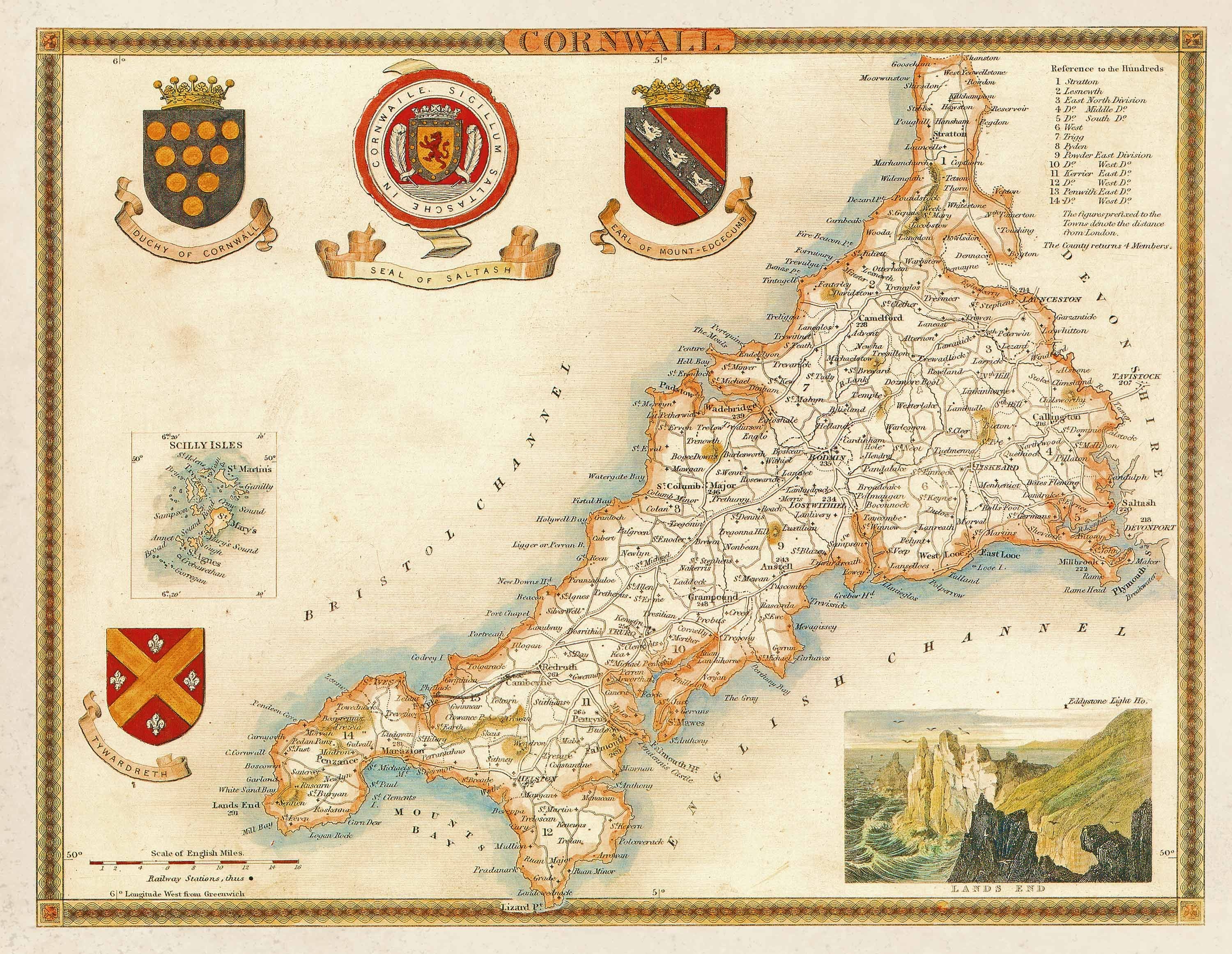
Français : Carte de la Cornouaille réalisée par Thomas Moule en 1851. |
| Date | |
| Source | http://www.oldmap.co.uk/OldCornishMap.php |
| Author | Thomas Moule (1850) |
Licensing
|
This work is in the public domain in its country of origin and other countries and areas where the copyright term is the author's life plus 100 years or fewer. | |
| This file has been identified as being free of known restrictions under copyright law, including all related and neighboring rights. | |
File history
Click on a date/time to view the file as it appeared at that time.
| Date/Time | Thumbnail | Dimensions | User | Comment | |
|---|---|---|---|---|---|
| current | 13:35, 11 December 2013 | | 3,000 × 2,324 (3.23 MB) | Thesupermat | User created page with UploadWizard |
File usage
The following pages on the English Wikipedia use this file (pages on other projects are not listed):