
File:The former Bacton Wood Watermill - geograph.org.uk - 646568.jpg
No higher resolution available.
The_former_Bacton_Wood_Watermill_-_geograph.org.uk_-_646568.jpg (640 × 480 pixels, file size: 72 KB, MIME type: image/jpeg)
| This is a file from the Wikimedia Commons. Information from its description page there is shown below. Commons is a freely licensed media file repository. You can help. |
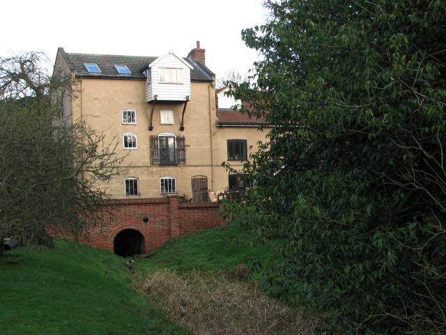
This is a photo of listed building number 1049148. |
Summary
| Description |
English: The former Bacton Wood Watermill. The last working mill was rebuilt in 1747. Extensive modification was carried out around 1825 due to an expected increase in trade, following the opening of the North Walsham & Dilham Canal in 1826. The North Walsham & Dilham Canal basically is the canalised River Ant, which was widened to accommodate Norfolk wherries that transported offal to two bone mills and took corn to Bacton Wood mill, with return loads consisting of flour. The canal ran from Smallburgh to Antingham and contained 6 locks. Originally of white rendered brick with a slate roof, the mill house had a Norfolk pantile roof, which in later years was changed to slate. The brick bridge spans a dry mill race; this is how it looks on the other side of the road > 646571. See also 649149 http://www.norfolkmills.co.uk/Watermills/bacton-wood.html |
| Date | |
| Source | From geograph.org.uk |
| Author | Evelyn Simak |
| Attribution (required by the license) | Evelyn Simak / The former Bacton Wood Watermill / |
| Camera location | | View this and other nearby images on: OpenStreetMap |
|---|
_heading:0.00&language=en)
| Object location | | View this and other nearby images on: OpenStreetMap |
|---|
_heading:0.00&language=en)
Licensing

|
This image was taken from the Geograph project collection. See this photograph's page on the Geograph website for the photographer's contact details. The copyright on this image is owned by Evelyn Simak and is licensed for reuse under the Creative Commons Attribution-ShareAlike 2.0 license.
|
This file is licensed under the Creative Commons Attribution-Share Alike 2.0 Generic license.
Attribution: Evelyn Simak
- You are free:
- to share – to copy, distribute and transmit the work
- to remix – to adapt the work
- Under the following conditions:
- attribution – You must give appropriate credit, provide a link to the license, and indicate if changes were made. You may do so in any reasonable manner, but not in any way that suggests the licensor endorses you or your use.
- share alike – If you remix, transform, or build upon the material, you must distribute your contributions under the same or compatible license as the original.
File history
Click on a date/time to view the file as it appeared at that time.
| Date/Time | Thumbnail | Dimensions | User | Comment | |
|---|---|---|---|---|---|
| current | 19:53, 11 March 2011 | | 640 × 480 (72 KB) | GeographBot | == {{int:filedesc}} == {{Information |description={{en|1=The former Bacton Wood Watermill The last working mill was rebuilt in 1747. Extensive modification was carried out around 1825 due to an expected increase in trade, following the opening of the Nort |
File usage
The following pages on the English Wikipedia use this file (pages on other projects are not listed):
Global file usage
The following other wikis use this file:
- Usage on www.wikidata.org