
File:Tellicoblockhouse4.jpg
Size of this preview: 798 × 599 pixels. Other resolutions: 320 × 240 pixels | 639 × 480 pixels | 1,023 × 768 pixels | 1,197 × 899 pixels.
Original file (1,197 × 899 pixels, file size: 247 KB, MIME type: image/jpeg)
| This is a file from the Wikimedia Commons. Information from its description page there is shown below. Commons is a freely licensed media file repository. You can help. |
Summary
|
This is an image of a place or building that is listed on the National Register of Historic Places in the United States of America. Its reference number is 75001771. |
| Description |
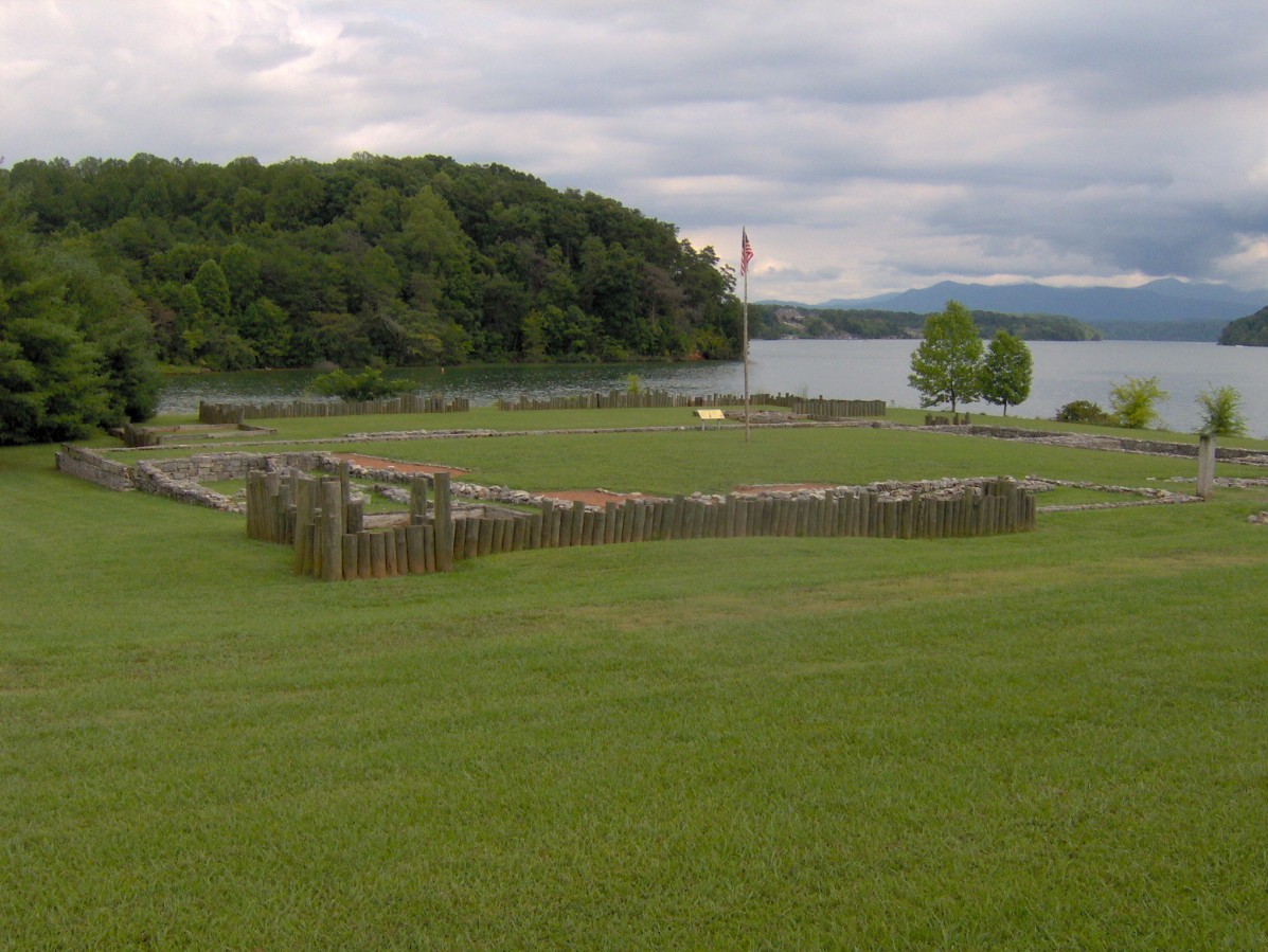
English: The Tellico Blockhouse site, with foundations and posts marking the original outline of the fort. The blockhouse was situated at the confluence of Nine Mile Creek (left) and the Little Tennessee River (right). The Unicoi Mountains rise in the distance. Image by Brian Stansberry. |
| Date | 25 June 2007 (original upload date) |
| Source | Transferred from en.wikipedia to Commons by Kurpfalzbilder.de using CommonsHelper. |
| Author | Bms4880 at English Wikipedia |
| Object location | | View this and other nearby images on: OpenStreetMap |
|---|
Licensing
Bms4880 at the English Wikipedia, the copyright holder of this work, hereby publishes it under the following license:

|
Permission is granted to copy, distribute and/or modify this document under the terms of the GNU Free Documentation License, Version 1.2 or any later version published by the Free Software Foundation; with no Invariant Sections, no Front-Cover Texts, and no Back-Cover Texts. A copy of the license is included in the section entitled GNU Free Documentation License. |
| This file is licensed under the Creative Commons Attribution-Share Alike 3.0 Unported license. | ||
| Attribution: Bms4880 at the English Wikipedia | ||
| ||
| This licensing tag was added to this file as part of the GFDL licensing update. |
Original upload log
The original description page was here. All following user names refer to en.wikipedia.
- 2007-06-25 22:10 Bms4880 1197×899× (253349 bytes) The Tellico Blockhouse site, with foundations and posts marking the original outline of the fort. The blockhouse was situated at the confluence of Nine Mile Creek (left) and the Little Tennessee River (right). The Unicoi Mountains rise in the distance.
File history
Click on a date/time to view the file as it appeared at that time.
| Date/Time | Thumbnail | Dimensions | User | Comment | |
|---|---|---|---|---|---|
| current | 23:10, 2 February 2009 | | 1,197 × 899 (247 KB) | File Upload Bot (Magnus Manske) | {{BotMoveToCommons|en.wikipedia}} {{Information |Description={{en|The Tellico Blockhouse site, with foundations and posts marking the original outline of the fort. The blockhouse was situated at the confluence of Nine Mile Creek (left) and the Little Te |
File usage
The following pages on the English Wikipedia use this file (pages on other projects are not listed):