
File:TOMS indonesia smog lrg.jpg
Original file (1,234 × 801 pixels, file size: 337 KB, MIME type: image/jpeg)
| This is a file from the Wikimedia Commons. Information from its description page there is shown below. Commons is a freely licensed media file repository. You can help. |
Summary
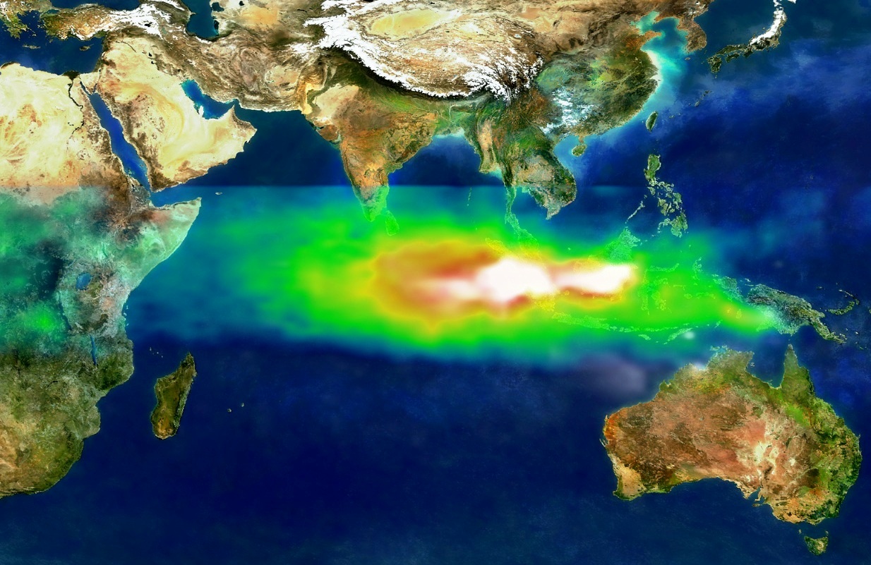
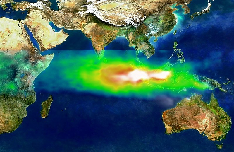
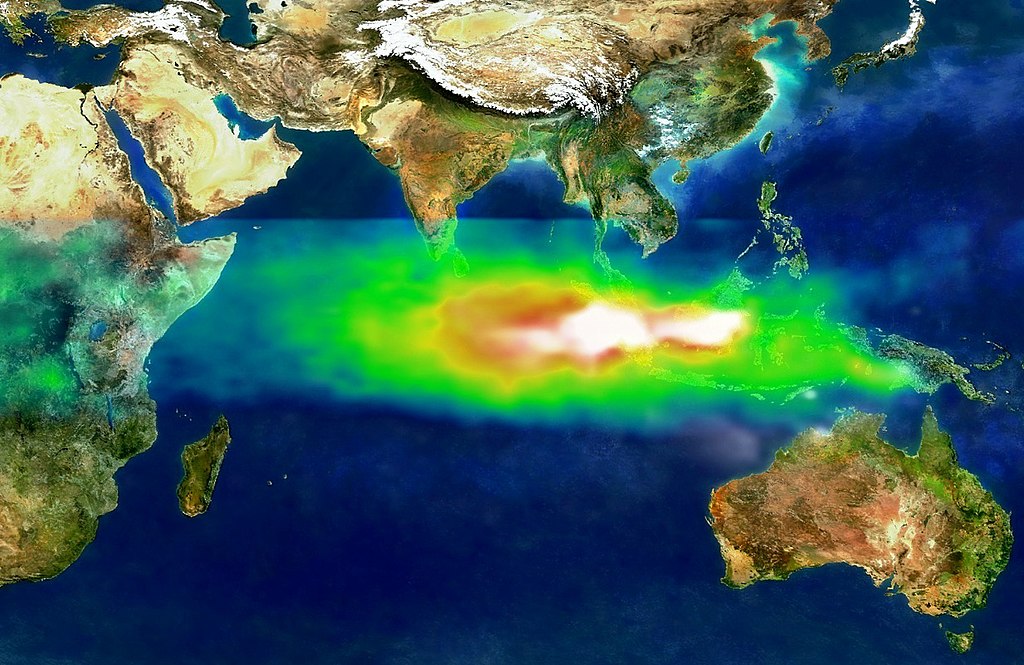
This image shows the pollution over Indonesia and the Indian Ocean on October 22, 1997. White represents the aerosols (smoke) that remained in the vicinity of the fires. Green, yellow, and red pixels represent increasing amounts of tropospheric ozone (smog) being carried to the west by high-altitude winds.
Researchers have discovered that smoke and smog move in different ways through the atmosphere. A series of unusual events several years ago created a blanket of pollution over the Indian Ocean.
In the second half of 1997, smoke from Indonesian fires remained stagnant over Southeast Asia while smog, which is tropospheric, low-level ozone, spread more rapidly across the Indian Ocean toward India.
Researchers tracked the pollution using data from NASA's Earth Probe Total Ozone Mapping Spectrometer (TOMS) satellite instrument. "TOMS is the only satellite instrument that follows both smoke and smog, globally," said Anne Thompson, NASA Earth Scientist at Goddard Space Flight Center, Greenbelt, MD. "The extreme pollution generated during the Indonesian fires was the first time we saw smoke move more slowly and in different directions from where smog moved."
http://visibleearth.nasa.gov/view_rec.php?id=1651
Licensing
| This file is in the public domain in the United States because it was solely created by NASA. NASA copyright policy states that "NASA material is not protected by copyright unless noted". (See Template:PD-USGov, NASA copyright policy page or JPL Image Use Policy.) | ||
 |
Warnings:
|
File history
Click on a date/time to view the file as it appeared at that time.
| Date/Time | Thumbnail | Dimensions | User | Comment | |
|---|---|---|---|---|---|
| current | 10:18, 12 September 2013 | | 1,234 × 801 (337 KB) | Soerfm | Crop, contrast |
| 00:58, 8 September 2005 |  | 1,280 × 960 (456 KB) | SEWilco | This image shows the pollution over Indonesia and the Indian Ocean on October 22, 1997. White represents the aerosols (smoke) that remained in the vicinity of the fires. Green, yellow, and red pixels represent increasing amounts of tropospheric ozone (smo |
File usage
Global file usage
The following other wikis use this file:
- Usage on ar.wikipedia.org
- Usage on cs.wikipedia.org
- Usage on de.wikipedia.org
- Usage on fi.wikipedia.org
- Usage on fi.wikinews.org
- Usage on fr.wikipedia.org
- Usage on id.wikipedia.org
- Usage on ig.wikipedia.org
- Usage on it.wikipedia.org
- Usage on ms.wikipedia.org
- Usage on ru.wikipedia.org
- Usage on ru.wikinews.org
- Usage on sv.wikipedia.org
- Usage on ta.wikipedia.org
- Usage on uk.wikipedia.org
- Usage on vi.wikipedia.org
- Usage on zh.wikipedia.org