
File:TL 02U 2020-12-11 0226Z.jpg
Size of this preview: 450 × 600 pixels. Other resolutions: 180 × 240 pixels | 360 × 480 pixels | 576 × 768 pixels | 768 × 1,024 pixels | 1,536 × 2,048 pixels | 3,603 × 4,804 pixels.
Original file (3,603 × 4,804 pixels, file size: 3.29 MB, MIME type: image/jpeg)
| This is a file from the Wikimedia Commons. Information from its description page there is shown below. Commons is a freely licensed media file repository. You can help. |
Summary
| Description |
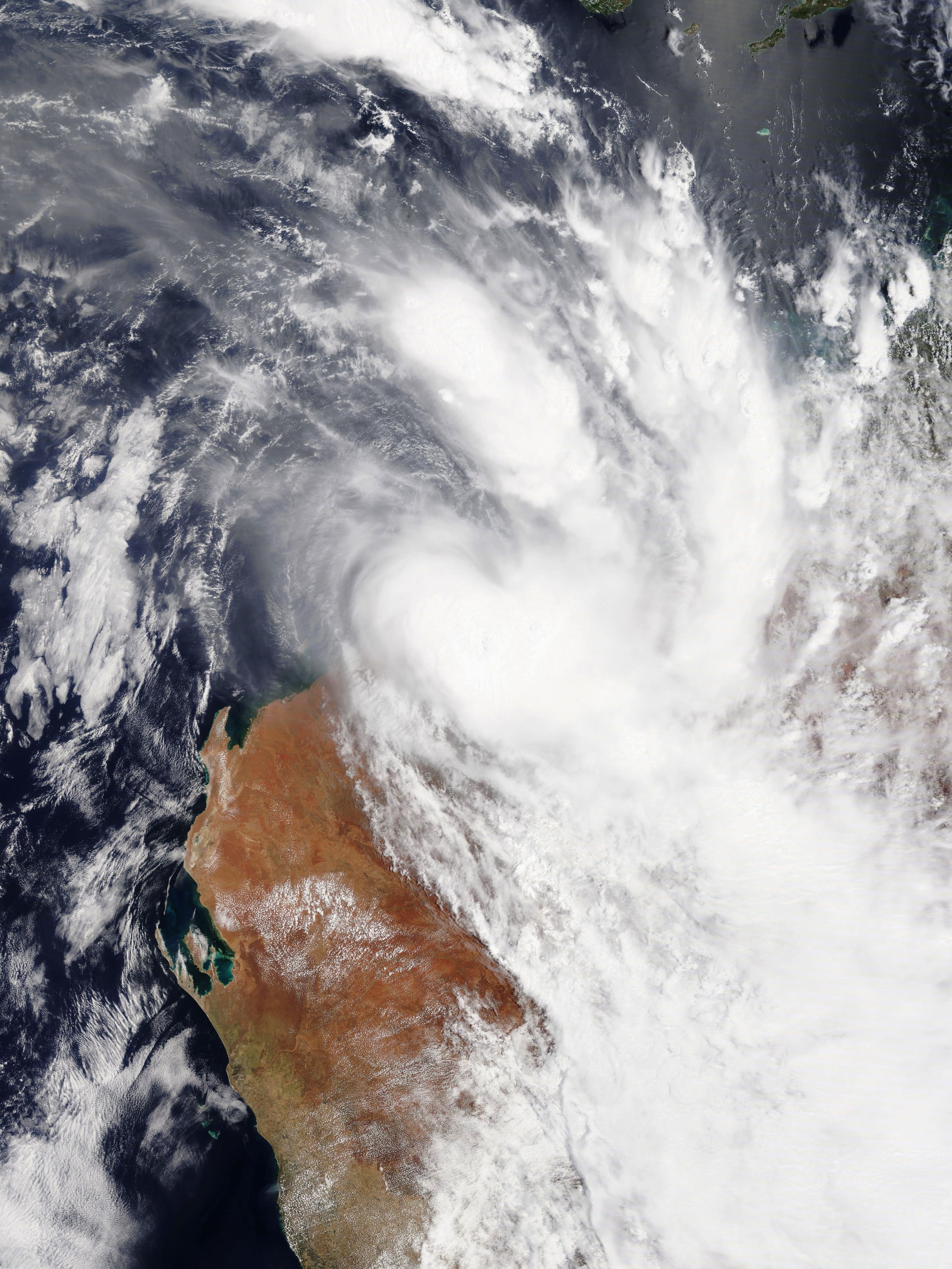
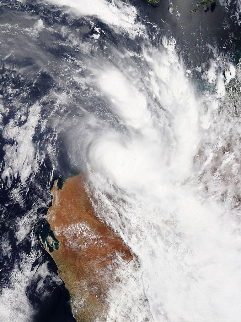
English: Tropical Low 02U about one hour after making landfall near Port Hedland in Western Australia on 11 December 2020. |
| Date | |
| Source | NASA Worldview |
| Author | National Aeronautics and Space Administration (NASA) – 'Terra' satellite |
Licensing
| This file is in the public domain in the United States because it was solely created by NASA. NASA copyright policy states that "NASA material is not protected by copyright unless noted". (See Template:PD-USGov, NASA copyright policy page or JPL Image Use Policy.) | ||
 |
Warnings:
|
File history
Click on a date/time to view the file as it appeared at that time.
| Date/Time | Thumbnail | Dimensions | User | Comment | |
|---|---|---|---|---|---|
| current | 02:42, 4 January 2021 | | 3,603 × 4,804 (3.29 MB) | Bidgee | Reverted to version as of 05:51, 11 December 2020 (UTC) Cease overwriting, see COM:OVERWRITE |
| 20:54, 3 January 2021 |  | 6,400 × 8,000 (6.05 MB) | FleurDeOdile | Reverted to version as of 14:46, 3 January 2021 (UTC) it is centered, stop reverting because someone uploaded a better version of your images | |
| 19:59, 3 January 2021 |  | 3,603 × 4,804 (3.29 MB) | ChocolateTrain | Reverted to version as of 10:03, 3 January 2021 (UTC) It quite clearly isn't centred | |
| 14:46, 3 January 2021 |  | 6,400 × 8,000 (6.05 MB) | FleurDeOdile | Reverted to version as of 18:03, 22 December 2020 (UTC) it is centred | |
| 10:03, 3 January 2021 |  | 3,603 × 4,804 (3.29 MB) | ChocolateTrain | Reverted to version as of 05:51, 11 December 2020 (UTC) Uncentred | |
| 18:03, 22 December 2020 |  | 6,400 × 8,000 (6.05 MB) | FleurDeOdile | 250m | |
| 05:51, 11 December 2020 |  | 3,603 × 4,804 (3.29 MB) | ChocolateTrain | Uploaded a work by National Aeronautics and Space Administration (NASA) – 'Terra' satellite from [https://worldview.earthdata.nasa.gov/?v=89.57520305074709,-34.72736600017927,146.27165029601636,-6.8589951211569495&l=OrbitTracks_Terra_Descending(hidden),Reference_Labels(hidden),Reference_Features(hidden),Coastlines(hidden),VIIRS_NOAA20_CorrectedReflectance_TrueColor(hidden),VIIRS_SNPP_CorrectedReflectance_TrueColor(hidden),MODIS_Aqua_CorrectedReflectance_TrueColor(hidden),MODIS_Terra_Corrected... |
File usage
The following pages on the English Wikipedia use this file (pages on other projects are not listed):
Global file usage
The following other wikis use this file:
- Usage on pt.wikipedia.org
- Usage on th.wikipedia.org
- Usage on vi.wikipedia.org
- Usage on zh.wikipedia.org