
File:TC Beni 29 jan 2003 0315Z.jpg
Size of this preview: 514 × 599 pixels. Other resolutions: 206 × 240 pixels | 412 × 480 pixels | 659 × 768 pixels | 878 × 1,024 pixels | 1,756 × 2,048 pixels | 5,200 × 6,064 pixels.
Original file (5,200 × 6,064 pixels, file size: 4.52 MB, MIME type: image/jpeg)
| This is a file from the Wikimedia Commons. Information from its description page there is shown below. Commons is a freely licensed media file repository. You can help. |
Summary
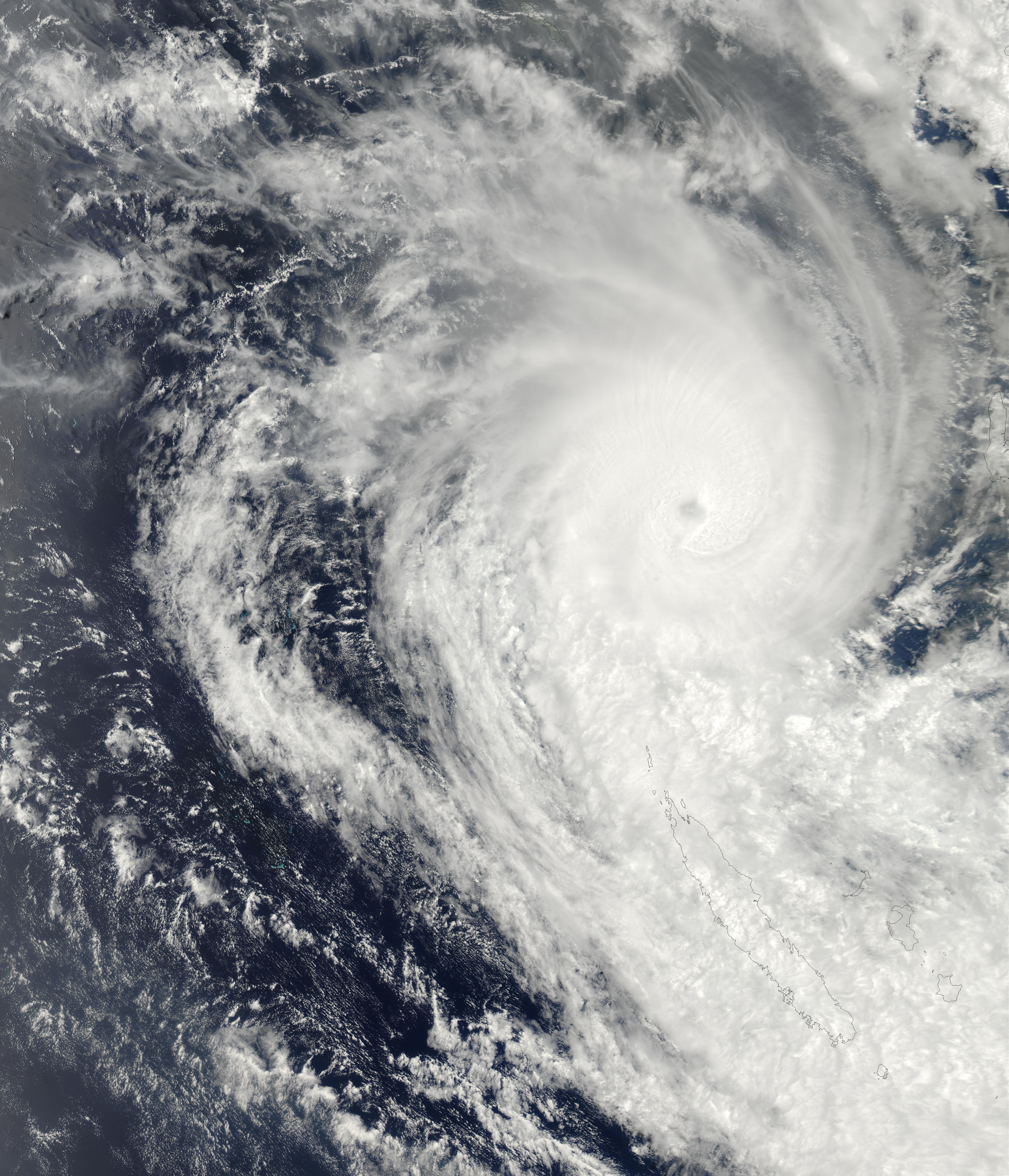
| Description | This true-color image from the MODIS instrument onboard NASA’s Aqua spacecraft shows Tropical Cyclone Beni located approximately 215 miles south-southeast Honiara, Solomon Islands, on Jan. 26. Beni’s maximum sustained winds were near 60 mph and the storm intensified over the subsequent 36-48 hours to 145 mph. Beni moved south toward New Caledonia over the next few days, under the influence of a low to mid-level ridge to the northeast. | |||||
| Date | ||||||
| Source | http://visibleearth.nasa.gov/view_rec.php?id=4895 | |||||
| Author | Jeff Schmaltz, MODIS Rapid Response Team, NASA/GSFC | |||||
| Permission (Reusing this file) |
|

File history
Click on a date/time to view the file as it appeared at that time.
| Date/Time | Thumbnail | Dimensions | User | Comment | |
|---|---|---|---|---|---|
| current | 03:25, 11 October 2006 | | 5,200 × 6,064 (4.52 MB) | Good kitty | == Summary == {{Information |Description=This true-color image from the MODIS instrument onboard NASA’s Aqua or Terra spacecraft shows Tropical Cyclone Beni located approximately 215 miles south-southeast Honiara, Solomon Islands, on Jan. 26. Beni’s m |
File usage
The following pages on the English Wikipedia use this file (pages on other projects are not listed):